| Directions
From the village of Lake Placid, proceed southeast on
NY 73. In North Elba, take a right toward Adirondack
Loj. The Van Hoevenbert trailhead is just east of
Heart Lake.
|
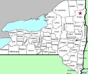
| County: |
Essex |
| Town: |
Keene |
| USGS Map: |
Keene Valley |
| Waterway: |
Marcy Brook |
| Latitude: |
N 44° 8' 26" |
| Longitude: |
W 73° 55' 45" |
| Drop: |
NA |
| Type: |
NA |
| Region: |
Off NY 73 between Lake Placid and Keene |
| Parking: |
NA |
| Trail type: |
NA |
| Length of hike: |
4.5 mile one-way |
| Difficulty: |
Difficult |
| Accessibility: |
Public |
| Name: |
Official |

|
Follow the Van Hoevenberg Trail, which starts near
the parking area at the Adirondack Loj, for 2.1 miles to Marcy Dam.
Continue on the main trail toward Mt. Marcy for another 2.4 miles. According
to Tony Goodwin, Executive Director of the Adirondack Trail Improvement
Society, the falls aren't that impressive, but the view of Algonquin
from the slabs above the falls is the real attraction. To
get to the bottom, one must take the Lake Arnold Crossover Trail
down for 75 yards. If anyone has any pictures of this waterfall, we would be very
interested in
hearing from
you. Our thanks to David Jones of Gouverneur, New
York for the photos we have.
The Marcy Brook empties into the West Branch of the Ausable River.
The west branch joins forces with the east branch in Ausable Forks.
The combined Ausable River empties into Lake Champlain in the town
of Peru.
The Heart Lake area by the Adirondack Loj provides the access
for Rocky Falls, MacIntyre Brook Falls, Indian Falls and the Lake
Colden Tributary Falls. Considering the length of the hike
to these areas, you might want to consider grouping these together.
Last update: November 17, 2015
|


