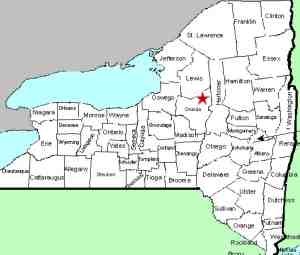
| Directions
This location is on NY 46, about 3.3 miles south of
the village of Boonville and 2.4 miles north of Pixley Falls State Park.
|
| County: |
Oneida |
| Town: |
Boonville |
| USGS Map: |
Boonville |
| Waterway: |
Lansing Kill |
| Latitude: |
N 43° 26' 01.35" |
| Longitude: |
W 75° 19' 38.54" |
| Drop: |
35' |
| Type: |
Classical Block |
| Region: |
South of Boonville |
| Trail type: |
Dirt |
| Length of hike: |
200' |
| Difficulty: |
Easy to moderate |
| Accessibility: |
Public |
| Name: |
Common |

|
 This waterfall is a little over two miles upstream from the very
popular Pixley Falls. There is a roadside pull-off on the east side of the highway.
A foot bridge is visible from the road. As you walk toward the
bridge, bear to the right of the creek and follow the steep foot trail
leading down to the base of the falls. This waterfall is a little over two miles upstream from the very
popular Pixley Falls. There is a roadside pull-off on the east side of the highway.
A foot bridge is visible from the road. As you walk toward the
bridge, bear to the right of the creek and follow the steep foot trail
leading down to the base of the falls.The waterfall you are
walking next to is Bakers Falls. Lansing Kill Falls is
across the stream at the base of it. This is a very intriguing area for the waterfaller.
From the same vantage point, you are looking at two very
nice waterfalls. Bakers Falls enters Lansing Kill at the
base of Lansing Kill Falls. Our thanks to Stacy Brown for
submitting these pictures. Our only trip here was in
mid-April and, although our photos show a lot of water, there is
no color. They are not very appealing to view!
Lansing Kill flows into the Mohawk River. This empties
into the Hudson River which flows into the Atlantic Ocean.
Last update: April 25, 2017
|


