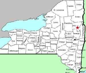
| Directions
Take NY 29 west from Saratoga Springs. The hamlet
of Rock City will be shortly after North Milton. Turn
left on Rt 49/Rock City Road. Park after crossing
the bridge and make the short walk back to see the falls.
|
| County: |
Saratoga |
| Town: |
Milton |
| USGS Map: |
Middle Grove |
| Waterway: |
Kayaderosseras Creek |
| Latitude: |
N 43° 3' 41" |
| Longitude: |
W 73° 55' 3" |
| Drop: |
15' |
| Type: |
Curtain cascade |
| Region: |
Off NY 29 between Saratoga Springs and Broadalbin |
| Parking: |
Roadside |
| Trail type: |
NA |
| Length of hike: |
None |
| Difficulty: |
Easy |
| Accessibility: |
Public |
| Name: |
Common |

|
This waterfall, once known as Big Falls, is visible
from the bridge over the creek. We assume this is a popular
picture-taking spot. Although there is a chain-link fence
along the edges of the bridge, presumably to keep people from jumping
into the water below, there is a small hinged "door" that
can be opened so that the fence doesn't obscure your photos.
There is a hydro-electric dam above the falls.
It might seem
to some that the industrial buildings adjacent to the falls mar
the beauty of the falls, and perhaps so, but the buildings are part
of the history of the town of Rock City Falls and of the falls too.
Adjacent to the bridge, there is a stone mill building that bears
the inscription "Rock City Mills 1859". The town
gets its name from the waterfall, but interestingly enough, the
falls is not registered on the USGS GNIS.
The
Kayaderosseras Creek empties into Saratoga Lake. The flow
then goes through Fish Creek to the Hudson River in Schuylerville.
The Hudson empties into the Atlantic Ocean in New York City.
Last update: November 8, 2015
|


