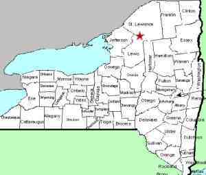
| Directions
Just east of the hamlet of Pitcairn, which is east of
Harrisville, look for the Jayville Road, which exits south
from NY 3. Coming from the east on Route 3, it is
3.9 miles from the intersection of St. Lawrence County Route
23. Drive up this road for just less than one mile
and the falls will be on the right.
|
| County: |
St. Lawrence |
| Town: |
Pitcairn |
| USGS Map: |
Harrisville |
| Waterway: |
Jenny Creek |
| Latitude: |
N 44° 10' 51" |
| Longitude: |
W 75° 15' 26" |
| Drop: |
30' |
| Type: |
Ribbon Cascade |
| Region: |
Off NY 3 between Harrisville and Fine |
| Parking: |
Roadside |
| Trail type: |
Roadside |
| Length of hike: |
Roadside |
| Difficulty: |
Easy |
| Accessibility: |
Private |
| Name: |
Unnamed |

|
 The Jenny Creek, which is no more than 4.8 miles
long, contains at least four waterfalls on about a two mile stretch
of the waterway. The one most downstream has a common local
name. The other three are unnamed. This one is the first
of the unnamed waterfalls that we know of on this stretch.
As such, we have dubbed it the Jenny Creek Lower Falls. The Jenny Creek, which is no more than 4.8 miles
long, contains at least four waterfalls on about a two mile stretch
of the waterway. The one most downstream has a common local
name. The other three are unnamed. This one is the first
of the unnamed waterfalls that we know of on this stretch.
As such, we have dubbed it the Jenny Creek Lower Falls.
The Jayville Road is paved for the first 0.8 miles and then turns
to dirt and gravel. You will come to this waterfall shortly
after entering the dirt portion.
The falls contain two drops totaling about 30 feet. There
are no trails, handrails or fences here, but due to their proximity
to the road, you can get a good view and several vantage points
allow you to take good pictures. The waterfall itself is
on property owned by a private hunting club but that really
isn't an issue. There is good visibility from the road's
right-of-way for pictures and viewing
The Jenny Creek flows into the Big Creek which flows into the
West Branch of the Oswegathchie River. This joins the main
channel of the Oswegatchie near the hamlet of Talcville in the town
of Edwards. From here it flows into the St. Lawrence River
in Ogdensburg.
Last update: July 1, 2017
|


