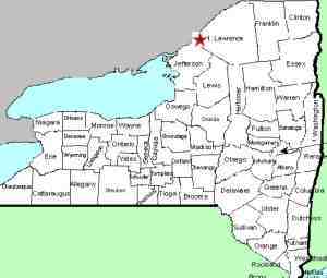
| Directions
Please refer to directions to
Rossie Falls.
From the corner of CR 3 and CR 8, drive about 3/4 of a
mile south on CR 3 and turn on Hall Road. This
drop is located by the bridge about 1000 feet up the
Hall Road.
|
| County: |
St. Lawrence |
| Town: |
Rossie |
| USGS Map: |
Muskellunge Lake |
| Waterway: |
Indian River |
| Latitude: |
N 44° 22' 09" |
| Longitude: |
W 75° 38' 54" |
| Drop: |
5' |
| Type: |
Ledge |
| Region: |
Northeast of Gouverneur |
| Parking: |
Roadside |
| Trail type: |
Dirt |
| Length of hike: |
1 minute |
| Difficulty: |
Easy |
| Accessibility: |
Private |
| Name: |
Unnamed |

|
This is a small, unnamed, roadside falls. It is visible
from a bridge on Hall Road, hence the naem.
We suspect
that the property is private, although it is not posted.
It is not far upstream from Rossie Falls.The Indian River continues its flow downstream through Black
Lake. Then it joins the Oswegatchie River which flows to the
St. Lawrence River in Ogdensburg.
Last update: October 26, 2017
|


