| Directions
From the intersection of US 11 and NY 177 in the village
of Adams Center, proceed east on 177. In about ten
miles, there will be a dirt road labeled Old State Road.
Take a left here. In less than a mile, you will come
to a parking area on the right.
|
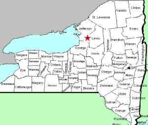
| County: |
Lewis |
| Town: |
Pinckney |
| USGS Map: |
Barnes Corners |
| Waterway: |
Gulf Stream |
| Latitude: |
N 43° 49' 58" |
| Longitude: |
W 75° 50' 07" |
| Drop: |
100' |
| Type: |
Ribbon cascade |
| Region: |
East of Adams |
| Parking: |
Unpaved lot |
| Trail type: |
Dirt |
| Length of hike: |
0.55 miles |
| Difficulty: |
Easy |
| Accessibility: |
Public |
| Name: |
Official |

|
Numerous on-line sources refer to Rainbow Falls
and Inman Gulf. Based on these, we were expecting a significant
hike to get there. Sources indicate a hiking trail of over
seven miles. We were pleasantly surprised. In fact,
this trail has several points of access. For anyone wanting
to simply find Rainbow Falls, you are looking at an overall walk
of about a mile.
Getting to the trailhead is also quite easy, if you know where
you are going. The sign at the corner of NY 177 indicates "Old
State Road" but the locals refer to this as Williams Truck
Road. That little bit of wisdom will not benefit you because
we saw no signs that ever used that term. Your trip down this
road is about one mile. Use our picture of the parking area
as a reference. It is just beyond a pond. If you reach
the county line and enter Jefferson County, you've gone too far.
On-line trail maps we found indicated that there is a point on
the trail where there is some type of registration kiosk and perhaps
a picnic area. We did not find them but we have
subsequently been advised by a contributor that they are there.
It is 1/4 mile from
the trailhead to a junction where you take a right and from that
point, it is another 0.3 miles. You are walking along the rim of
the gulf. There is a marked viewing point for the falls, but
it is distant. Foliage is also not in your favor during the
season. This is a free-fall cascade and a tall one.
Various on-line sources put it at anywhere from 260 to 300'.
We also found pictures on-line that were obviously taken from the
stream level but that access was not known to us prior to our
visit. Shortly after, we spoke with a neighbor who has
been there on stream level on a number of occasions. We
have not had a chance to get back there but it is in our plans.
This area is a winter paradise. You are on the Tug Hill
here and snowfall is legendary. Many in this area make their
livelihood during the winter months, with snowmobiling, skiing and
snowshoeing being the norm.
Our application to the BGN was accepted on June 11, 2017.
This is now the official name of this waterfall.
The Gulf Stream flows into the Sandy Creek which flows into Lake
Ontario.
Last update: July 31, 2017
|


