| Directions
From US 11 in the hamlet of Mooers Forks, take
Davison Road/CR 14 west. At Cannon Corners, turn
right on CR 10. In a little over a mile, Rock Road
will exit to the left. You will come to a parking
area.
|
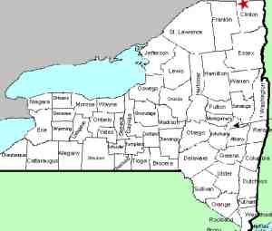
| County: |
Clinton |
| Town: |
Mooers |
| USGS Map: |
Ellenburg Depot |
| Waterway: |
The Gulf |
| Latitude: |
N 45o 00' 05" |
| Longitude: |
W 73o 47' 59" |
| Drop: |
60' |
| Type: |
Ribbon Cascade |
| Region: |
NW of Plattsburgh |
| Parking: |
Unpaved lot |
| Trail type: |
Dirt |
| Length of hike: |
2.6 mile, one-way |
| Difficulty: |
Moderate |
| Accessibility: |
Public |
| Name: |
Unnamed |
|
We have only recently become aware of this location.
On-line information indicates that you should follow the red
trail markers from the parking lot. There is a 60 foot
waterfall near the end of the 2.6 mile long trail.
The trail is reportedly quite flat. We have noted it
to be a moderate hike because of the length. The trail
ends at the Canadian border.
This waterfall is apparently on the bank descending into this
canyon-like region. Topographical maps do not indicate the
source or exit of this waterway known as "The Gulf". We
are also in contact with a contributor who has hiked this
region. Additional information will be posted as we get
it.
Last update: April 26, 2020
|


