| Directions
As you drive into Canton on US 11, you will cross the
bridge over the Grass River. The next right
is Miner Street. Follow this and
just past the St. Lawrence University campus, you will
cross another bridge over the Grass. This
waterfall is under and just upstream of this bridge.
|
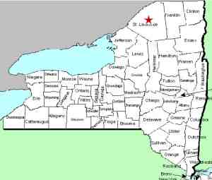
| County: |
St. Lawrence |
| Town: |
Canton |
| USGS Map: |
Canton |
| Waterway: |
Grass River |
| Latitude: |
N 44o 34' 58.44" |
| Longitude: |
W 75o 09' 58.69" |
| Drop: |
NA |
| Type: |
Rapids |
| Region: |
South of the village of Canton |
| Parking: |
Unpaved lot |
| Trail type: |
Roadside/dirt |
| Length of hike: |
Roadside |
| Difficulty: |
Easy |
| Accessibility: |
Public |
| Name: |
Common |

|
It
is actually quite generous to call this a waterfall. It is
a stretch of rapids, and not a very vigorous one at that!
Had we driven by it probably wouldn't even have warranted a
stop. However, it has been known in this area as Leighs Falls for many
years so we felt compelled to include it.
It gets its name from a Leigh family (pronounced
Lee) that were early residents of Canton. In fact, at one
time there was a Leigh Street in the village. This one
block long street connected Miner Street to Park Street but was
closed a number of years ago and became part of the SLU campus.
There is an island in the river at this point so this is a
two-part drop. You are actually less than 200 feet from
the village limits here and less than 400 feet upstream, the
Little River joins the Grasse. This river is one of the
larger tributaries of the Grass and the last significant feeder
to flow into it before it reachs the St. Lawrence River.The Grass River flows into the St. Lawrence River in Massena,
in St. Lawrence County.
Note: Depending upon which map or sign you are using, this
river is referred to as either Grasse or Grass.
Officially, it is Grass.
Last update: April 16, 2017
|


