| Directions
From the north: In Canton, drive out Park Street
past St. Lawrence University. This becomes St. Lawrence
County Route 27. It will take you through a small
corner of the town of Russell, the town of Pierrepont and
into the town of Clare. Shortly after crossing into
the town of Clare, the sign will be on your right.
From the south: on New York State Route 3 just east
of Fine, you will find the end of CR 27. A short distance
down this road, CR 27 will make a right hand turn on to
a road known locally as the Cracker Box Road. In a
few miles, this will come to a "T" where you take
a right in the hamlet of DeGrasse. From this corner
(the intersection of CR 17 and CR 27), go 4.6 miles.
|
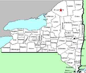
| County: |
St. Lawrence |
| Town: |
Clare |
| USGS Map: |
West Pierrepont |
| Waterway: |
Grass River |
| Latitude: |
N 44° 24' 20" |
| Longitude: |
W 75° 04' 01" |
| Drop: |
40' |
| Type: |
Curtain cascade |
| Region: |
Southeast of Canton |
| Parking: |
Roadside |
| Trail type: |
Dirt |
| Length of hike: |
0.5 mile |
| Difficulty: |
Easy |
| Accessibility: |
Public |
| Name: |
Official |

|
 Lampsons Falls is perhaps the most popular waterfall
in St. Lawrence County, New York. The trailhead is just north
of an airstrip which is north of the hamlet of DeGrasse. Lampsons Falls is perhaps the most popular waterfall
in St. Lawrence County, New York. The trailhead is just north
of an airstrip which is north of the hamlet of DeGrasse.
We first have some comments on the name. As an officially
named waterfall, it is listed on the USGS GNIS data base.
Here it is called Lampsons Falls. Topographical maps also
refer to it as Lampsons. Locally, however, it is called Lampson.
The trailhead is clearly marked by DEC signs for the "Grass
River Wild Forest" and these signs indicate Lampson Falls.
The ½ mile trail in is well maintained and easy to walk.
One-half way in, there is a bulletin board and a registration stand.
They ask you to sign in and check out. The DEC does this at
a number of sites to track use. Please use this. It
is their way of justifying expenditures for maintenance and improvements.
It is also a way to make sure everyone going in, comes out!
There is even a handicapped access portion at the end leading down
to a very close view of the waterfalls.
There are several trails you can take. On the handicapped
access portion, there is a trail to the left that takes you
to the crest of the falls. At the end of the handicapped access
trail, you can simply continue down to the beach area and then across
to the point of land that juts out below the falls for a great downriver
view. As an alternative, a short distance in the handicapped
access trail, you will come to a fallen tree. You will be
looking at the bottom of the root structure. Just to the left
of this there is a trail that leads to the beach.
The area is very popular with locals and students from area colleges.
While we were there in November 2009, there were six kayakers from
Canada heading in. Canoeing, kayaking, hiking and even camping
are common here. It is also a year-round area. Cross-country
skiers and snowshoers use this area in the winter.
It is significant to note that some publications list Lampsons
Falls as being on the South Branch of the Grass River. In
reality, the North Branch splits a few miles downstream of this
area and the river breaks into the Middle Branch and the South
Branch a few miles upstream. The stretch containing
Lampsons Falls is the main section of the Grass.
It is a view of Lampsons Falls that is used in the banner of
this website.
The Grass River flows into the St. Lawrence River in Massena,
in St. Lawrence County.
Note: Depending upon which map or sign you are using, this
river is referred to as either Grasse or Grass.
Officially, it is Grass.
Last update: April 26, 2016
|


