| Directions
From the junction of CR 17 and CR 27 in the hamlet of Degrasse,
proceed northeast on CR 27. In 7.4 miles, take a left
on the Downerville Road, just 1/2 mile past the Clare town barn.
The trailhead is 1/2 mile down this road.
|
| County: |
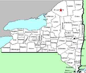
St. Lawrence |
| Town: |
Clare |
| USGS Map: |
West Pierrepont |
| Waterway: |
North Branch of the Grass River |
| Latitude: |
N 44o 26' 07" |
| Longitude: |
W 75o 04' 29" |
| Drop: |
60' |
| Type: |
Slide |
| Region: |
Southeast of Canton |
| Parking: |
Unpaved lot |
| Trail type: |
Dirt |
| Length of hike: |
0.6 mile |
| Difficulty: |
Easy |
| Accessibility: |
Public |
| Name: |
Official |

|
 Harper Falls is located just a few miles from Lampsons
Falls. There are a couple of things that should be noted about
this location. First of all, the signs in the area call this
the Downerville Road. Some sources call this the Donnerville
Road. This road was named after an early settler in the area
and over the years, the spelling has somehow gotten twisted. Harper Falls is located just a few miles from Lampsons
Falls. There are a couple of things that should be noted about
this location. First of all, the signs in the area call this
the Downerville Road. Some sources call this the Donnerville
Road. This road was named after an early settler in the area
and over the years, the spelling has somehow gotten twisted.
Secondly, some publications give directions to these falls from
the north end of this road where it meets CR 24. If you come
in from the north end, you may be in for a walk. This is a
seasonally maintained dirt road that has been improved greatly in
recent years. For the most part, with the right vehicle, you
can travel from end to end during most of the year. There
still may be times however, when there is water over the road in
the swampy areas. The DeGrasse end is much more direct, and
predictable.
Once on the hike, you have about a fairly easy 12 minute walk over a well
maintained trail. You will be rewarded
with a very pretty waterfall in a somewhat remote setting.
Our thanks to Bill Hill of
Hiking the Trail to Yesterday for providing the video.
The Grass River flows into the St. Lawrence River in Massena,
in St. Lawrence County.
Note: Depending upon which map or sign you are using, this
river is referred to as either Grasse or Grass.
Officially, it is Grass.
Last update: April 3, 2020
|


