| Directions
The north end of the Tooley Pond Road is less than 1000'
from the junction of CR 17 and CR 27 in the hamlet of Degrasse.
Proceed northeast on CR 27 and take a right. You will
reach Bulkhead Falls in 3.5 miles.
|
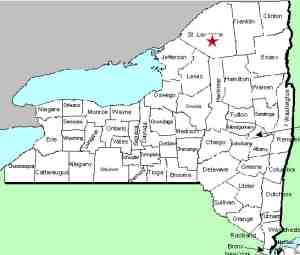
| County: |
St. Lawrence |
| Town: |
Clare |
| USGS Map: |
Degrasse |
| Waterway: |
Grass River South Branch |
| Latitude: |
N 44o 19' 49" |
| Longitude: |
W 75o 01' 06" |
| Drop: |
25' |
| Type: |
Ribbon Cascade |
| Region: |
South of Canton |
| Parking: |
Roadside |
| Trail type: |
Dirt |
| Length of hike: |
0.1 mile |
| Difficulty: |
Easy |
| Accessibility: |
Public |
| Name: |
Common |

|
 Bulkhead Falls is one of eight
well-known waterfalls on the South Branch of the Grass River which
are fairly easy to access from the Tooley Pond Road. This
road connects CR
27 in the hamlet of Degrasse to NY 3 near Cranberry Lake.
Like many of the falls on this road, it is on DEC maintained state
land, accessible to the public. It is also possible to reach
this location from the Route 3 end but our information details access
from the north. Bulkhead Falls is one of eight
well-known waterfalls on the South Branch of the Grass River which
are fairly easy to access from the Tooley Pond Road. This
road connects CR
27 in the hamlet of Degrasse to NY 3 near Cranberry Lake.
Like many of the falls on this road, it is on DEC maintained state
land, accessible to the public. It is also possible to reach
this location from the Route 3 end but our information details access
from the north.
A mileage reading to reach the trailhead is pretty important.
The trail is fairly well defined and easy to navigate but you
have to find it first. The DEC has recently placed new
trailhead signs throughout this area, but not for Bulkhead
Falls. That is probably because it is the only major
waterfall in this section that is not officially named. At about 3.5 miles from the CR 27
end, you will crest a small hill and the road will level
somewhat for a short distance. This is about 0.4 mile past
the Twin Falls trailhead sign.
There is a yellow sign that states "No motor vehicles allowed
beyond this point". Just south of that, you will find a trail
that takes you to Bulkhead. This is not the only
trail to this waterfall and none of them are obvious. This
is the best option because it takes you to the bottom of the
falls.
Just past this point, the road and river are very close
together. If you look downstream, you are actually looking
over the crest of the falls. This will give you some idea
of where you should stop your hike.
The Grass River flows into the St. Lawrence River in Massena,
in St. Lawrence County.
Note: Depending upon which map or sign you are using, this
river is referred to as either Grasse or Grass.
Officially, it is Grass.
Last update: July 8, 2017
|


