| Directions
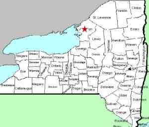
From Watertown, travel north on US 11. Just
north of the city, NY 37 will veer left. Follow
this for about 8.7 miles and you will come to the Keyser
Road/CR 17. Take a left and follow this to the
end. Take a right on the Perch Lake Road/CR 15 and
you will shortly come to a dirt road on the left.
A sign at the end of the road identifies it as the Perch
Lake Wildlife Refuge, a State of New York property.
|
| County: |
Jefferson |
| Town: |
Pamelia |
| USGS Map: |
Brownville |
| Waterway: |
Gillette Creek |
| Latitude: |
N 44o 07' 30" |
| Longitude: |
W 75o 52' 52" |
| Drop: |
8' |
| Type: |
Curtain cascade |
| Region: |
North of Watertown |
| Parking: |
Roadside |
| Trail type: |
Dirt |
| Length of hike: |
0.1 mile |
| Difficulty: |
Easy |
| Accessibility: |
Private |
| Name: |
Unnamed |

|
 Although
the sign mentioned in the direction side-bar suggests that this
is state land, the wildlife refuge is actually further down the
road. We found that this waterfall is on private property
several years after our visit. The last time we were
there, this property was not posted. However, there were a
couple of posts that look like they could have held posted signs
but no signs were displayed. Although
the sign mentioned in the direction side-bar suggests that this
is state land, the wildlife refuge is actually further down the
road. We found that this waterfall is on private property
several years after our visit. The last time we were
there, this property was not posted. However, there were a
couple of posts that look like they could have held posted signs
but no signs were displayed.
This waterfall can actually be seen from I-81,
but you have to know where to look. It should go without
saying that with traffic flowing at Interstate speeds, this
would not be the best option for viewing a waterfall! Due
to the orientation of the creek as it approaches the highway,
the view is actually over your shoulder as you pass it.
The waterfall itself is a pleasant little drop that we estimate
to be of about eight feet.
Gillette Creek flows into Perch Lake, which is a wide spot in the
Perch River, at an area known as the Perch River Wildlife Management
Area. This, in turn, flows into the Black River Bay which
is on the eastern end of Lake Ontario.
Last update: April 19, 2019
|


