| Directions
Located on NYS Route 73, this site is just south of the
hamlet of Saint Huberts, which is on the stretch between
the village of Keene Valley and the northern intersection
of routes 73 and 9. Look for the signs for the Giant
Mountain Wilderness Area. The parking area for AMR
is directly across the road.
|
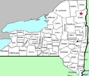
| County: |
Essex |
| Town: |
Keene |
| USGS Map: |
Keene Valley |
| Waterway: |
Gill Brook |
| Latitude: |
N 44° 08' 11" |
| Longitude: |
W 73° 47' 57" |
| Drop: |
10' |
| Type: |
Flume |
| Region: |
Off NY 73 near the hamlet of St. Huberts |
| Parking: |
Unpaved lot |
| Trail type: |
Dirt/rock |
| Length of hike: |
1.2 miles beyond the gate on Lake Road |
| Difficulty: |
Moderate |
| Accessibility: |
Access by easement |
| Name: |
Unnamed |

|
Please refer to our page for the general information on
The Adirondack
Mountain Reserve. This waterfall is located within
that facility.
About 1.1 miles from the gate on the Lake Road, there is a wooden
bridge crossing the Gill Brook. Not more than 0.1 mile downstream
from there, you will find the Gill Brook Flume. Signs in the
area identify it simply as "The Flume".
Portions of this area are reminiscent of High Falls Gorge, although
on a much smaller level. There are several steps as the brook
descends at the top of this area and then the water finds its way
through a very narrow crevice in the rocks. The rock walls
are probably fifteen feet high here. The last three pictures
in the array shows this crevice in the rocks. This is the
first of several waterfalls on this tiny tributary of the Ausable.
The Gill Brook empties into the East Branch of the Ausable River
not far downstream from here. The east branch joins forces
with the west branch at Au Sable Forks to form the Ausable River,
which empties into Lake Champlain in the town of Peru.
Last update: May 29, 2020
|


