| Directions
Proceed south from Adams on US 11. About three
miles after leaving the village, take a left on the
Lemay Road. Continue 2.2 miles. The pavement
will end and you will come to a pull-off on the left.
Park here.
|
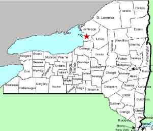
| County: |
Jefferson |
| Town: |
Lorraine |
| USGS Map: |
Adams |
| Waterway: |
Fox Creek |
| Latitude: |
N 43o 45' 52" |
| Longitude: |
W 76o 00' 05" |
| Drop: |
~48' |
| Type: |
Ribbon Cascade |
| Region: |
Southeast of Adams |
| Parking: |
Roadside |
| Trail type: |
Dirt |
| Length of hike: |
0.2 mile, one-way |
| Difficulty: |
Easy to moderate |
| Accessibility: |
Public |
| Name: |
Common |

|
 This waterfall is a very pretty and easy to access location.
From the parking pull-off, you can actually see the waterfall
from within a few feet of your vehicle. On the north side
of the road, which is dirt at this point, there is a flat area
that juts out toward the gorge. As you approach the edge
the falls will be in view on the other side. Use caution
here. It is a very steep drop! This waterfall is a very pretty and easy to access location.
From the parking pull-off, you can actually see the waterfall
from within a few feet of your vehicle. On the north side
of the road, which is dirt at this point, there is a flat area
that juts out toward the gorge. As you approach the edge
the falls will be in view on the other side. Use caution
here. It is a very steep drop!
The trailhead will
be obvious just west of the pull-off. You will walk down a
grade for 0.1 mile and then the trail hooks a sharp right and
continues to the creek level. It is a gentle walk,
although it is a bit more strenuous coming back out! The
vertical drop is about 90 feet.
Fox Creek is the waterway
flowing through this gorge. The waterfall is technically
not on this creek. It is on an unnamed stream emptying
into the Fox Creek that traces its source a little less than two
miles east of here, just west of the hamlet of Lorraine.
This area is part of the Jefferson County Forest and Wildlife
Management Area. It is publicly accessible but we would
urge visitors to be more respectful than some who have been
there previously. There is evidence of a lot of trash that
was left behind by disrespectful guests!
This area has
apparently been a popular recreation/hiking location for locals
for many years. We have talked with several people who
either live in the area or grew up there who said they always
knew the area as Mooney Gulf. In fact, many maps and
decades old topographical quadrangles identify this as Totman
Gulf, which is on the north side of Lemay Road. Mooney
Gulf is an area no more than 1/4 mile south of here, between
Lemay Road and the Comstock Road. Several sources have
told us that there are no waterfalls in the Mooney Gulf and this
is the only on in the Totman Gulf.
Fox Creek flows into the South Sandy Creek which empties into
Lake Ontario just north of the Jefferson/oswego County Line. Last update: April 30, 2016
|


