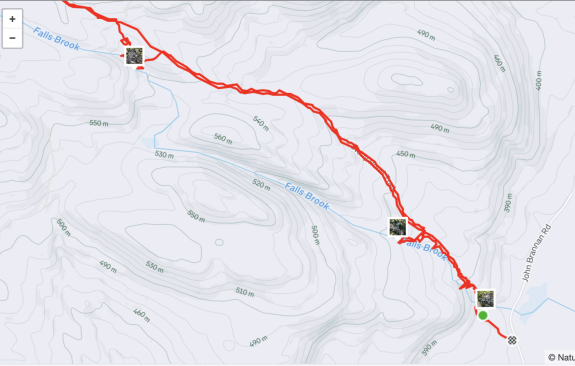
| Directions
From NY 28N in the hamlet of Minerva, go east on Town
Shed Road. This becomes Longs Hill Road after
crossing AP Morse Highway/Essex Counth 30. It then
becomes John Brannon Road at the junction with O'Neil
Road. 3/10 of a mile past this junction, you will
come to a trailhead marker. A pull-off for parking
is across the road.
|
| County: |
Essex |
| Town: |
Minerva |
| USGS Map: |
Scroon
Lake |
| Waterway: |
Falls
Brook |
| Latitude: |
N 43°
48' 22.82" |
| Longitude: |
W 73°
57' 08.54" |
| Drop: |
~ 20' |
| Type: |
Cascade |
| Region: |
Off NY 28N
in MInerva |
| Parking: |
Roadside |
| Trail type: |
Dirt |
| Length of
hike: |
0.15 mile,
one-way |
| Difficulty: |
Easy |
| Accessibility: |
Private |
| Name: |
Unnamed |

|
First of all, our thanks to Gary Dilmore for his pictures and
information on this location. Please note that Google Maps
and Bing Maps refer to the John Brannon Road as Town Shed Road,
which becomes Longs Hill Road. It then becomes John
Brannon Road
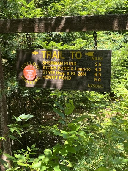
For starters it is important to note that the first half
mile of this hike is over private property. The trail is on
a an old jeep type road, is easy to follow and has minimal
elevation gain. There are DEC markers and snowmobile trail
markers along this stretch so it is ok to
hike through but you will see Private Property-No
Trespassing signs along the way so stick to the trail.
Additionally, the first waterfall is also on private
property, just off the trail so proceed own risk.
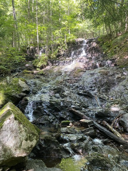
From the trailhead, follow the trail for .15 mile, you can
catch a glimpse of the first waterfall from the trail. When
you reach the brook crossing you will be just a few yards
upstream from the waterfall. We walked down a short side
trail just before reaching the brook in order to capture a
photo of the falls. The main falls is approximately a 20
foot
drop and the brook continues to drop beyond that but we did
not go any further downstream. There is a house down
toward the bottom, so this is likely private property.
Falls Brook enters Minerva Stream just below this waterfall. This
enters Trout Brook just east of Olmstedville which, in turn, joins
Schroon River near Pottersville/Exit 26 of I-87. The
Schroon flows into the Hudson River just west of Warrensburg,
which ultimately flows to the Atlantic Ocean.
Last update: July 23, 2025
|