| Directions
This waterfall is located on private property and its
exact location isn't known to us.
|
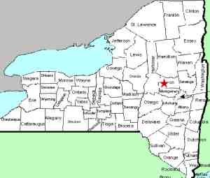
| County: |
Herkimer/Montgomery |
| Town: |
Manheim/St. Johnsville |
| USGS Map: |
oppenheim |
| Waterway: |
East Canada Creek |
| Latitude: |
N 43o 1' 14" |
| Longitude: |
W 74o 44' 32" |
| Drop: |
25' |
| Width: |
Ribbon Cascade |
| Region: |
West of St. Johnsville |
| Parking: |
NA |
| Trail type: |
NA |
| Length of hike: |
NA |
| Difficulty: |
NA |
| Accessibility: |
Private |
| Name: |
Common |

|
Beardslee Falls is listed in Russell
Dunn's Mohawk Region Waterfall Guide as a "historic" waterfall.
The entry goes on to indicate that it is not accessible because
it is on private land. To us, a historic waterfall is one that
once existed, but for whatever reason, no longer does. There
are two waterfalls in St. Lawrence County, for example, that are
listed on the USGS GNIS, but are no longer there because they were
flooded over when dams were built on the Raquette River.
All indications are that this waterfall does still exist.
The coordinates we have listed are approximations based on various
information found. If anyone has more specific information,
please contact us.
The East Canada Creek forms the boundary line between Herkimer
and Montgomery Counties in this region. We have tentatively
placed this waterfall on the county line. Please note, however,
that there is actually a stretch of this creek, just north of where
we believe this waterfall to be, where the county line veers east
toward the bank on the Montgomery County side. It is possible
that if the waterfall is slightly north of where we believe it to
be, that is is entirely in Herkimer County.
Also according to Russell Dunn, there is another waterfall, about
15' tall, just upstream of this location.
The East Canada Creek flows into the Mohawk River just downstream
of this waterfall. The flow then continues into the Hudson
River before reaching the Atlantic ocean in New York City.
Last update: August 10, 2015
|


