| Directions
The information on this waterfall was viewer contributed.
We do not have access directions.
|
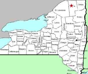
| County: |
Franklin |
| Town: |
Santa Clara |
| USGS Map: |
Lake Titus |
| Waterway: |
Deer River |
| Latitude: |
N 44o 40' 19" |
| Longitude: |
W 74o 20' 52" |
| Drop: |
NA |
| Type: |
Curtain cascade |
| Region: |
off route 30 between St. Regis Falls and
Duane Center |
| Parking: |
NA |
| Trail type: |
NA |
| Length of hike: |
NA |
| Difficulty: |
NA |
| Accessibility: |
Public |
| Name: |
Unnamed |

|
our thanks to Don Feltham of West Linn oregon who
has contributed the information and photos of this waterfall.
The waterfall is technically unnamed. We are referring to
it as the Deer River Lower Falls because it is on the Deer River,
just downstream from another waterfall. We have been to this
area but have not been able to locate the exact site. Since
we have not been there, our coordinate information is approximate.
It is our understanding that this location is just downstream on
the Deer River from an area known as Deer River Flow, near Duane
Center in Franklin County. Topographical maps of the area
note rapids at this point.
We spoke with two gentlemen at a campground there and neither
knew of the existence of waterfalls on this stretch. We suspect
that this might have to be reached by canoe.
If anyone has any additional information on this waterfall, please
contact us.
The Deer River flows into the St. Regis River, which flows north
into Canada and then empties into the St. Lawrence River a short
distance downstream from the New York/Quebec border.
Updated: May 15, 2015
|


