| Directions
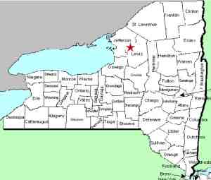
This waterfall is located on the Deer River just downstream
from Copenhagen. It is, however, bordered by private
land on both sides of the river and is not publicly accessible.
|
| County: |
Lewis |
| Town: |
Denmark |
| USGS Map: |
Copenhagen |
| Waterway: |
Deer River |
| Latitude: |
N 43o 53' 50" |
| Longitude: |
W 75o 39' 49" |
| Drop: |
166' |
| Type: |
Plunge |
| Region: |
Northeast of Copenhagen |
| Parking: |
NA |
| Trail type: |
NA |
| Length of hike: |
NA |
| Difficulty: |
NA |
| Accessibility: |
Private |
| Name: |
Official |

|
There is no shortage of waterfalls named High Falls
in northern New York! This one is located a short distance
downstream on the Deer River from Copenhagen, New York. Bordered
on both sides by private land, we extend our thanks to Doug Carlson
for guiding us in. As a NYS DEC Biologist, he is very familiar
with many waterways in the area. As a resident of this particular
area, he knows the landowners and has access. Otherwise, please
beware. We have actually seen documents indicating the public
availability of this area. That may be the case if you are
kayaking upstream from below these falls, but not if you are hiking
in.
There is a 59' power dam just upstream from this cascade.
You can actually see the dam from the Deer River Road, northwest
of the falls, but you need to hike down into the area to see the
falls. We were there in early September, during a long, dry
spell, so there wasn't as much water flowing as there are at other
times. We were on the top of the ridge southeast of the river,
looking down at the falls and into the gorge.
The Deer River flows to the Black River which empties into Lake
ontario at the Black River Bay, just southwest of the village of
Dexter.
Last update: August 9, 2015
|


