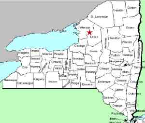
| Directions
The upper area is visible looking south from the bridge
on NY 12 in the village of Copenhagen. The remaining
drops can be reached by turning on the road between the
Cottage Inn and the river. This will take you to a
dirt/stone road that leads into an old quarry where you
will see this section less than .1 mile in.
|
| County: |
Lewis |
| Town: |
Denmark |
| USGS Map: |
Copenhagen |
| Waterway: |
Deer River |
| Latitude: |
N 43o 53' 31" |
| Longitude: |
W 75o 40' 21" |
| Drop: |
~ 10' |
| Type: |
Step/curtain cascades |
| Region: |
Just east of the village of Copenhagen |
| Parking: |
Unpaved lot |
| Trail type: |
Dirt, stone |
| Length of hike: |
0.1 mile |
| Difficulty: |
Easy |
| Accessibility: |
Public |
| Name: |
Unnamed |

|
An unnamed section, we have dubbed this area Copenhagen
Falls, since it is located in that village. Spanning an area
of about a tenth of a mile or so of the river, we have included
it because it is an interesting span of topography. It is
typical of the sheets of rock in this area.
The upper area, which is visible looking south from the bridge
on NY 12, contains four or five drops of around three feet each
which are actually quite unimpressive. Just downstream of
this, there are several other drops of eight to ten feet each, just
upstream from High Falls. The river probably drops a total
of 50 feet in this stretch. The largest drop is no more than
10 feet, which is what we have indicated in the chart.
The Deer River flows into the Black River which empties into
Lake ontario just outside of Dexter, just west of Watertown in Jefferson
County.
Last update: August 9, 2015
|


