| Directions
Take Exit 23 from I-87 and go west to US 9 in Warrensburg.
Take a right on US9 and go 0.8 mile, where you should turn
left on NY418. This road will become CR2 and will
end at a "T" just after crossing the Hudson River.
Take a left and then a quick right and you will be on Athol
Road/CR13. In a little over 3 miles, bear left on
the Valley Road/CR36. Continue until coming to the
Garnet Lake Rd S on your left. In one mile you will
come to a dirt road on your right (Ski Hi Road). Two
miles down this, you will find the trailhead.
|
| County: |
Warren |
| Town: |
Johnsburg |
| USGS Map: |
Johnsburg |
| Waterway: |
Crane Mountain Pond outlet |
| Latitude: |
N 43o 33' 01" |
| Longitude: |
W 73o 58' 30" |
| Drop: |
NA |
| Type: |
NA |
| Region: |
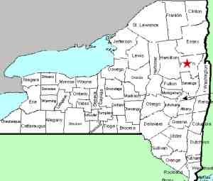
Off US 9 northwest of Warrensburg |
| Parking: |
Roadside |
| Trail type: |
Dirt |
| Length of hike: |
1.3 mile |
| Difficulty: |
Moderate |
| Accessibility: |
Public |
| Name: |
Unnamed |

|
We have now been to this location, at least the
trailhead, but didn't get all the way in to the waterfall.
When we were there in May 2013, it had been raining for several
days and the area was extremely wet. Even parts of the road
in the area where you park was covered with water, and it was raining
quite heavily when we were there. Between the weather, the
distance in, and because it was late in the day and we have several
others in that area to locate, we opted to abort this one and plan
a return trip.
We found the roads in this area somewhat confusing. When
we were on the Ski Hi Road, for example, there was one sign that
called it the Sky Hi Road. To complicate things even more,
mapquest.com calls it Sky High Road. Garnet Lake Rd S became
Garnet Lake Rd, then Garnet Lake Rd N and back to Garnet Lake Rd
without warning. Also, there were a couple of intersections
on this one where you needed to turn to stay on the same road!
It is our understanding that once on the trail, go straight along
the old farm road. You will be going northwest. Do not
go right toward Crane Mountain. In about 0.8 miles, the trail
will fork where you should bear right. You will come to Crane
Mountain Pond where you will find the waterfall at the outlet of
the pond.
On September 26, 2019, we received this account from Adam
Pearsall ...
"There are actually a few waterfalls on Crane, buy only one that
runs (mostly) year round, which as you note is the outlet from
the pond. There are waterfalls to the north (between
Northwest (Bates) ridge and Northeast ridge), east (a few small
falls to the east of the pond) and south that run primarily in
spring, though may also run after a good rainstorm when the
ground is saturated.
"The "blue trail" (blue markers) up
from Putnam Junction or down from the pond parallels the course
of the water. Please note that a good portion of the lower
trail is on private property.
"To reach that section of
trail:
-From Ski Hi Road parking lot head North along the old
tote road towards Putnam Junction
-At the "Stop" barrier
follow the rail to the right up the mountain
"As you get
higher up the mountain you get closer to the course of the
water. Once you are 2/3 of the way up or so you are on
state land. The trail crosses the water not far from the
pond; it can be slippery at times."
If anyone else has any information on this waterfall or pictures of
it, we would like to hear from
you.
Shelving Rock Brook empties into Lake George. The water
from this then flows through La Chute into Lake Champlain.
The flow then goes north through Canada on the Richelieu River and
empties into the St. Lawrence River.
Last update: September 30, 2019
|


