| Directions
From the intersection of NY 12 and NY 365, just north
of Barneveld, proceed north on NY 12. The first right
will be the Plank Road and the second right from that is
the Prospect Junction Road. You will almost immediately
cross the Cincinnati Creek. The waterfall is under
this bridge and just downstream from it.
|
| County: |
Oneida |
| Town: |
Trenton |
| USGS Map: |
Remsen |
| Waterway: |
Cincinnati Creek |
| Latitude: |
N 43o 18' 32" |
| Longitude: |
W 75o 11' 03" |
| Drop: |
NA |
| Type: |
Step |
| Region: |
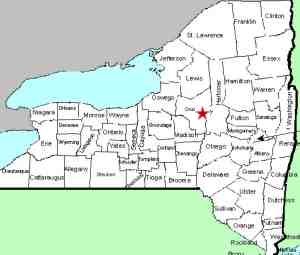
Between Remsen and Barneveld |
| Parking: |
Roadside |
| Trail type: |
Dirt |
| Length of hike: |
0.1 mile |
| Difficulty: |
Easy |
| Accessibility: |
Public, parts private |
| Name: |
Unnamed |

|
 The
section is actually a series of six or seven drops over a stretch
of about 300 yards. About 500' upstream from the bridge is
the first drop that can be seen. It looks to be about five
or six feet tall. Approximately half way between the bridge
and that drop is a second drop of only three feet or so. Just
upstream of the bridge is another five or six foot drop and then
you are looking over the crest of another drop of about the same
height on the downstream side of the bridge. The
section is actually a series of six or seven drops over a stretch
of about 300 yards. About 500' upstream from the bridge is
the first drop that can be seen. It looks to be about five
or six feet tall. Approximately half way between the bridge
and that drop is a second drop of only three feet or so. Just
upstream of the bridge is another five or six foot drop and then
you are looking over the crest of another drop of about the same
height on the downstream side of the bridge.
There are two or three more drops further downstream that can
not be seen from the bridge. Better views of the rest of the
drops are available from downstream. Please note, however,
that the land on both sides of the creek, both upstream and downstream
are private property. There is a private road exiting the
Plank Road just downstream from this bridge. One of our contributors
was granted permission from the landowner to photograph the area
from there. In this section, there is a drop before the creek
splits around a small island. Just below the island, there
is another drop and then a slide that completes the stretch.
The Cincinnati Creek flows into the West Canada Creek just downstream
of the Trenton Falls area. This empties into the Mohawk River,
which then flows into the Hudson before reaching the Atlantic Ocean.
Last update: October 4, 2017
|


