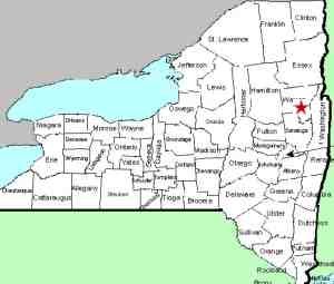
| Directions
From the hamlet of Lake Luzerne, proceed north on NY
9N. In 2.4 miles, as you pass signs for Fourth Lake,
take a left on Gailey Hill Road. This ends on
the Thomas Road where you will take a left. The pavement
ends on this road and soon after, the road ends and you
take a right on River Road, although it may not be marked
as such. Drive about 1.3 miles until reaching the
Hudson River Recreation Area, where you can park.
|
| County: |
Warren |
| Town: |
Warrensburg |
| USGS Map: |
Warrensburg |
| Waterway: |
Buttermilk Brook |
| Latitude: |
N 43o 24' 14" |
| Longitude: |
W 73o 52' 23" |
| Drop: |
50' |
| Type: |
Slide |
| Region: |
North of Lake Luzerne |
| Parking: |
Unpaved lot |
| Trail type: |
Dirt |
| Length of hike: |
0.5 mile |
| Difficulty: |
Easy to moderate |
| Accessibility: |
Public |
| Name: |
Common |

|
The trailhead for this waterfall is less than 1/4
mile beyond this parking area. You can walk, or the road is
quite passable so you can keep driving. Whichever is your
preference, after crossing Buttermilk Brook, there is a trail leading
right. You will find the waterfall within 1/2 mile.
Be looking for the sluice-way under the road. It is more evident
than the brook. A small parking area is just past this.
Also be aware that, although the hike in is only 1/2 mile, the
first 2/10 is rather intense. It is by no means a cliff, but
it is a steep uphill grade. That is why we have indicated
the difficulty as "easy to moderate". Most of it
isn't bad at all, but seasoned hikers will know they've been walking
when they get to the level at the top, which leads to the moderate
tag.
We have heard stories of what bears do in the woods. Apparently
in this area, they slide! Located on Buttermilk Brook, the
common name of this waterfall is Buttermilk Falls, but it is also
known as Bear Slide or Bear Slide Falls. We prefer referring
to this one as Bear Slide Falls for a couple of reasons. There
is no shortage of falls named Buttermilk, whereas Bear Slide is
more unique. Secondly, as you view this waterfall and think
of the term Bear Slide, you can almost envision a bear sliding down
the slippery, smooth rocks under this creek.
The waterfall is a beauty. You actually reach the creek-bed
at 35/100 of a mile, but the top is still in the distance.
This is a slide that goes forever! Because of the size of
this thing, we could post many pictures. In fact, we took
over 50 photos while here. We continued up the hill for another
1/10 of a mile and still didn't see the top of it. There are plenty
of crags and boulders in this stream, but much of it is a huge,
smooth chunk of rock. In most places there is only a couple
of inches of water flowing over it. Even the trail shares
some of the same qualities and when we were there in late May, there
were small streams of water on the trail.
This would be an ideal spot to bring your picnic lunch or at
least a snack. There are picnic tables throughout the area
and there appear to be camping opportunities as well.
Buttermilk Brook empties into the Hudson River less than 1/2
mile downstream of this point. The Hudson empties into the
Atlantic ocean in New York City.
Last update: July 29, 2015
|


