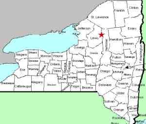
| Directions
In the village of Lowville, less than 1/4 mile south
of the intersection of NY 12 and NY 26, NY 12 crosses the Mill
Creek. Just south of here, take River Street east.
This becomes the Number Four Road. Just past Watson,
be aware that this road takes a left-hand turn. From
this point, you will continue another 11.9 miles where you
will come to a trail/dirt road on the right.
|
| County: |
Lewis |
| Town: |
Watson |
| USGS Map: |
Number Four |
| Waterway: |
Burnt Creek |
| Latitude: |
N 43o 50' 31" |
| Longitude: |
W 75o 13' 26" |
| Drop: |
NA |
| Type: |
NA |
| Region: |
East of Lowville |
| Parking: |
Roadside |
| Trail type: |
NA |
| Length of hike: |
NA |
| Difficulty: |
NA |
| Accessibility: |
NA |
| Name: |
Unnamed |

|
We have not yet been to this location. our directions and
information on it have been taken from maps. Although not
an officially named waterfall, it is indicated as "falls"
on topographical maps. We do not know if the dirt road/trail
referred to in the directions side-bar is passable by a motor vehicle
or if is even public. If you can get down it, it is about
one mile to a point where a trail exits to the right. A half-mile
down this trail, you will reach a point that is just upstream from
the waterfall.
The map also show a possible alternative access. Continuing
another 1.1 miles down this road/trail will take you to the other
side of the creek in the area of the waterfall. No trail is
noted in this area so it may be a possible bush-whack in.
Again, we stress that we have not been to this location so we
can't confirm our data.
If anyone has any information or pictures of these waterfalls,
we would be very interested in
hearing from you.
The Burnt Creek originates in the Adirondack foothills in the
town of Watson. It flows into the Independence River which
in turn flows into the Black River.
Last update: July 29, 2015
|


