| Directions
2.3 miles west of the I-87 exit 29 on the Blue Ridge
Road, there is a pull-off on the south side of the road.
This is within sight of the waterfall.
|
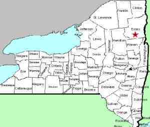
| County: |
Essex |
| Town: |
North Hudson |
| USGS Map: |
Blue Ridge |
| Waterway: |
The Branch |
| Latitude: |
N 43o 57' 22" |
| Longitude: |
W 73o 46' 52" |
| Drop: |
20' |
| Type: |
Series |
| Region: |
West of US 9 and I-87, south of North Hudson |
| Parking: |
Roadside shoulder |
| Trail type: |
Roadside |
| Length of hike: |
Roadside |
| Difficulty: |
Roadside |
| Accessibility: |
Public |
| Name: |
Common |

|
 Blue
Ridge Falls is easy to find and has a roadside view. This area
is very popular as a swimming spot by the locals in the summer.
From the parking area, walk west, upstream, away from I-87.
You will find a small road entrance leading to a short trail
over the bank. This will take you to the riverbank.
We do urge caution because our information is that the trail can
be a bit tricky as it is steep and the pine needles can make it
slippery. Blue
Ridge Falls is easy to find and has a roadside view. This area
is very popular as a swimming spot by the locals in the summer.
From the parking area, walk west, upstream, away from I-87.
You will find a small road entrance leading to a short trail
over the bank. This will take you to the riverbank.
We do urge caution because our information is that the trail can
be a bit tricky as it is steep and the pine needles can make it
slippery.
The river forms a gentle "S" at this point and it drops
in multiple steps. You can see about six steps as you look
upriver and there are at least six more as the river bends behind
the trees. Your view of that is somewhat obscured due to the
foliage. The total drop of the river is about 20' over about
400' of distance.
The Branch empties into the Schroon River just southwest of the
hamlet of North Hudson. The Schroon flows through Schroon
Lake and then continues its journey to the Hudson River just outside
of the village of Warrensburg. The Hudson flows into the Atlantic
Ocean in New York City.
Last update: August 30, 2016
|


