| Directions
We are researching specific information on getting to
this location.
|
| County: |
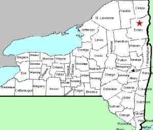
Essex |
| Town: |
North Hudson |
| USGS Map: |
Witherbee |
| Waterway: |
Boquet River, South Branch |
| Latitude: |
N 44o 05' 26" |
| Longitude: |
W 73o 43' 26" |
| Drop: |
NA |
| Type: |
Multiple falls |
| Region: |
South of Keene |
| Parking: |
NA |
| Trail type: |
NA |
| Length of hike: |
NA |
| Difficulty: |
NA |
| Accessibility: |
Public |
| Name: |
Unnamed |

|
According to a variety of information we have found
on several websites, there are several small waterfalls on this
stretch of waterway. We have noted that this is in the town
of North Hudson but that is a guess. This stretch actually
spans a distance and may cross into the town of Keene.
If anyone has any pictures or information on this waterfall,
we would be very interested in
hearing from
you.
The South Fork of the Boquet River joins forces with the north
fork just downstream from here, near the routes 73 and 9 interchange.
The Boquet then flows into Lake Champlain near Willsboro, New York.
Last update: July 29, 2015
|


