| Directions
This location is on NY 46, about 3.2 miles south of
the village of Boonville and 2.5 miles north of Pixley Falls State Park.
|
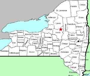
| County: |
Oneida |
| Town: |
Boonville |
| USGS Map: |
Boonville |
| Waterway: |
The Old Black River Canal |
| Latitude: |
N 43° 26' 05" |
| Longitude: |
W 75° 19' 45" |
| Drop: |
8' |
| Type: |
Classical Block |
| Region: |
South of Boonville |
| Trail type: |
Dirt |
| Length of hike: |
1000' |
| Difficulty: |
Easy |
| Accessibility: |
Public |
| Name: |
Unnamed |

|
 This waterfall is about two-and-a-half miles upstream from the very
popular Pixley Falls. It is just north of the roadside pull-off
for Bakers Falls and Lansing Kill Falls, but is accessed from
the same point. Rather than descending the bank to those
two falls, simply walk north along the cross-country ski trail. This waterfall is about two-and-a-half miles upstream from the very
popular Pixley Falls. It is just north of the roadside pull-off
for Bakers Falls and Lansing Kill Falls, but is accessed from
the same point. Rather than descending the bank to those
two falls, simply walk north along the cross-country ski trail.
There is some confusion as to what waterway
this is on.
It is part of the old Black River Canal, which hasn't been in
operation since 1925. We are tentatively calling it the
Lock 64 Falls because it is formed at the upstream end of that
former lock. You can still see the remains of the
sidewalls of it.
Since the canal no longer exists,
it is more likely that this stretch is part of an unnamed stream
that flows from the west side of NY 46 and into the Lansing Kill
just south of here. Our only trip here was in mid-April
and the foliage had not yet blossomed. Our pictures were
very brown so thanks to Stacy Brown for submitting this picture.
Lansing Kill flows into the Mohawk River. This empties
into the Hudson River which flows into the Atlantic Ocean.
Last update: April 25, 2017
|


