| Directions
This area can be viewed from both sides of the river.
For the park area, turn on Riverside Drive in Carthage.
This short street is at the end of the Route 126 bridge
spanning the two villages. At the end of the street
is a small park area. Distance views can be had by
crossing the river and going into West Carthage. Turn
right on North Main Street and in four blocks merge left
onto Champion Street. Follow the boat launch signs.
|
| County: |
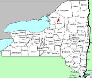
Jefferson |
| Town: |
Champion/Wilna |
| USGS Map: |
Carthage |
| Waterway: |
Black River |
| Latitude: |
N 43o 58' 46" |
| Longitude: |
W 75o 36' 56" |
| Drop: |
~ 20' |
| Type: |
Curtain cascade |
| Region: |
In the village of Carthage |
| Parking: |
Parking lot |
| Trail type: |
Paved/dirt |
| Length of hike: |
2 minutes |
| Difficulty: |
Easy |
| Accessibility: |
Public |
| Name: |
Common |

|
The Long Falls got its name because of its length.
It spans a very wide portion of the Black River between the villages
of Carthage and West Carthage. There are a number of islands
in this region. and a number of falls were there. Many years
ago a power dam was built between two of the islands. As a
result, from a waterfall perspective, this area is not
as impressive as it probably once was. Retaining
dams were placed at some of the other parts of the channel but there
is still evidence of the falls below these. There are also
other small drops around the islands. The Black River empties into Lake ontario at the Black River
Bay, just southwest of the village of Dexter.
Last update: July 29, 2015
|


