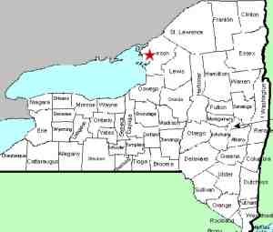
| Directions
From exit 46 on I-81, proceed west on NY 12F. A
short distance past the airport, there is the intersection
with NY 180. Just after taking the right turn into
the village of Dexter, the dam and waterfall will be in
sight on the right from the bridge over the Black River.
|
| County: |
Jefferson |
| Town: |
Hounsfield/Brownville |
| USGS Map: |
Dexter |
| Waterway: |
Black River |
| Latitude: |
N 44o 00' 12" |
| Longitude: |
W 76o 02' 30" |
| Drop: |
20' |
| Type: |
Dam |
| Region: |
Just off NY 180 in the village of Dexter |
| Parking: |
Roadside |
| Trail type: |
Dirt |
| Length of hike: |
<0.1 mile/1 minute |
| Difficulty: |
Easy |
| Accessibility: |
Public |
| Name: |
Unnamed |

|
If you want to view the falls from the bridge, it
would be best to park on the roadside before crossing the bridge
(across the river from the village of Dexter) and then walk to the
bridge. There are however, some options.
Back on route 12F just before reaching 180, there are two roads,
Lee Road and Old State Road, that form a loop and skirt the river.
This area is popular with fishermen and women. Some parking
is available on the roadside there and there are multiple trails
to the river. You can get up close and personal with the falls.
There is now a hydro facility on the Dexter side of the river.
On the Lee Road side, there is a retaining dam. At the base
of that, there is still a little waterfall, leading us to wonder
what the area looked like before the dam was built. We
have learned that this dam was built
in the early 1800s. Historical accounts about Great Falls,
upstream in Watertown, indicate that it was the first real
impediment to fish moving upstream from the lake. That
would indicate that any elevation changes in the Dexter area
were small.
John Stano, Dexter Village Historian, has told us that he is
not aware of any pictures of the area before the dam's
installation. He has found text references to the area
that implies that this region was more accurately rapids, rather
than a waterfall. This entry is probably more significant
to the history of this region, rather than to the current
situation.
The flow here is controlled by a
number of dams upstream. There are times when the flow over
this one is just a trickle, either because of activity upstream
or because of dryer weather.
The Black River empties
into one of the lake's bays just downstream of here.
Last update: December 17, 2016
|


