| Directions
From I-81, exit 48, follow NY 342 east to its end.
Take a left on NY 3 and within 1/4 mile, you will cross
the Black River twice in rapid succession. Immediately
after the second crossing, there is a parking area for the
Black River Trail on the right.
|
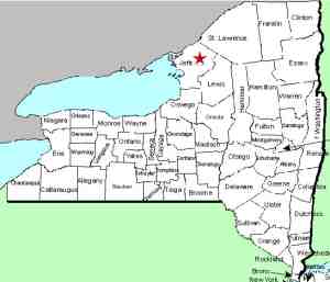
| County: |
Jefferson |
| Town: |
Rutland |
| USGS Map: |
Black River |
| Waterway: |
Black River |
| Latitude: |
N 44o 00' 05" |
| Longitude: |
W 75o 48' 24" |
| Drop: |
~ 12' |
| Type |
Step |
| Region: |
East of Watertown |
| Parking: |
Paved lot |
| Trail type: |
Paved trail |
| Length of hike: |
1/2 mile one-way |
| Difficulty: |
Easy |
| Accessibility: |
Public |
| Name: |
Unnamed |

|
The Black River Trail is a very popular paved walking/running/biking
trail that runs along the Black River between the city of Watertown
and the village of Black River. There are a number of power
facilities through this area, both commercial and municipal.
Some people define a waterfall by its drop. In other words,
if it isn't a certain height, it isn't considered a waterfall.
There has to be a point at which this has to be considered.
It has been the policy of this website to consider the body of water
containing the waterfall as well. Many falls are on unnamed
streams but if the stream or creek isn't even shown on a topographical
map, one has to consider whether it is a waterway and not just seasonal
run-off. This page actually details three waterfalls and two
of them are at locations where an established stream is not shown.
We are including them because they are flowing most of the year.
Even in late summer, these falls are active. Since this area
has a vigorous winter, that is the only time that the flow isn't
there. There is a pond just east of this area and we believe
that one of these falls is on the outlet of that, even though the waterway doesn't
show on topo maps.
As mentioned, there are three falls along this trail. The
first is 1/10 mile or so past the gate at the parking area.
You will come to a small fenced in facility by a canoe portage sign.
There is a solar collector with two PA horns on top. on your
left, a small creek is flowing just off the path. Just past
this facility, there is a sluice pipe under the path. The
water going through here feeds this waterfall. Just past this
sluice, you can make your way to the river's edge and get up close
and personal with the waterfall. The information in the data
side-bar is for this waterfall.
A very short distance further downstream, there is a second,
smaller, similar waterfall. We have pictures showing both
of these together and the first and second falls individually.
Technically, these first two falls are on these unnamed and uncharted
feeder streams.
Another 1/4 mile or so down the path you will go under some power
lines. Follow the clearing under them to the river's edge.
Across the river, there is a third waterfall, at the base of the
retaining dam at this hydro facility. There is a large ledge between the dam and the
falls, probably about eight feet above the river level. Depending
upon flow, some of the water finds its way through crevices in the
ledge before dropping over the lower drop of three feet or so.
Unlike the first two waterfalls, this one is on the Black River,
rather than a feeder stream. Also, it is just over the line
into the Rutland Center topographical quadrangle. You can make your
way down the shoreline and get a nice view of this area from further
downstream. There is an alternative path to the river from
the trail through a clearing about 200' or so beyond the power lines.
The Black River empties into Lake ontario at the Black River
Bay, just southwest of the village of Dexter.
Last update: June 2, 2020
|


