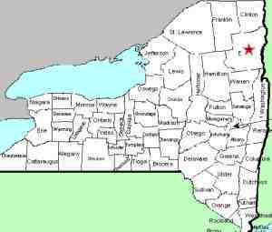
| Directions
On NY 73 between St. Huberts and the intersection of
US 9, you will find the Zander Scott trailhead.
|
| County: |
Essex |
| Town: |
Keene |
| USGS Map: |
Elizabethtown |
| Waterway: |
Beede Brook |
| Latitude: |
N 44o 08'
13" |
| Longitude: |
W 73o 44'
32" |
| Drop: |
NA |
| Type: |
Step |
| Region: |
South of Keene |
| Parking: |
Unpaved lot |
| Trail type: |
Dirt |
| Length of hike: |
1/4 mile |
| Difficulty: |
Easy |
| Accessibility: |
Public |
| Name: |
Unnamed |

|
This
is an unnamed waterfall located near the trailhead of the Zander
Scott Trail. It appears to be on the Beede Brook so we
have named it as such because it is downstream of a more
prominent waterfall on this brook. This area is in the shadows of Giant
Mountain, one of the Adirondack's High Peaks, off NY 73.
Like many waterfalls in this area, it may well be seasonal.
Topo maps show Beede Brook, the outlet of Chapel Pond, flowing
through the Keene Valley. Since the inlet of this pond isn't
labeled, one would assume it is a continuation of Beede Brook, but
several on-line sources call it Dipper Brook. Dipper is a
smaller pond, less than a mile east of Chapel Pond. Bing Maps
do not identify it but Google Maps do call it Beede Brook so we
have gone that route.
The Beede Brook flows through Chapel Pond and then continues
into the East Branch of the Ausable River. The East Branch
and the West Branch join forces downstream at Au Sable Forks to
form the Ausable River. This waterfall rich river empties
into Lake Champlain in the town of Peru.
Last update: August 30, 2019
|


