| Directions
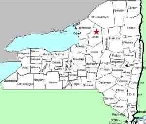
The hamlet of Beaver Falls is located on NY126 between
Carthage and Croghan. As you come through the
village, you will be driving somewhat parallel to the Beaver
River on the north. The only bridge over the river
in this area is on Main Street/CR35. Cross the bridge
and look for the park on your left.
|
| County: |
Lewis |
| Town: |
Croghan/New Bremen |
| USGS Map: |
Croghan |
| Waterway: |
Beaver River |
| Latitude: |
N 43° 53' 0" |
| Longitude: |
W 75° 25' 44" |
| Drop: |
12' |
| Type: |
Slide |
| Region: |
In the hamlet of Beaver Falls between Carthage
and Croghan |
| Parking: |
Street-side |
| Trail type: |
Dirt |
| Length of hike: |
2 minutes |
| Difficulty: |
Easy |
| Accessibility: |
Public |
| Name: |
Common |

|
In the hamlet of Beaver Falls, there are signs on
this corner for the Beaver Falls Post office and the Lewis County
Health Center.
The waterfall is located behind the Beaver Falls Recreation Park.
There is a picket fence surrounding this facility but several sections
have either fallen down or been taken down and you can access the
river bank. Unfortunately, the best views of the waterfall
would be from downstream on the other side of the river and there
is no access from there. You can, however, get views from
beside the falls.
Although there has been a hydro-electric facility at this location
for many years, there is still a slide-type waterfall below the
dam. The flow then levels out for a short stretch before a
small cascade. Another 100' or so below this the level drops
again. These are the drops you really can't see from the river's
edge so it is difficult to gauge the height. Also, the lower
drop appears to be quite symmetrical from above so we don't know
if this is a natural falls or a man-made structure. It would
not seem to make sense that there would be another dam this soon
below the dam above the falls.
The Beaver River flows into
the Black River, which empties into Lake ontario at the Black River
Bay, just southwest of the village of Dexter.
Last update: July 28, 2015
|


