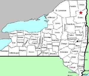
| Directions
From the village of Lake Placid, proceed east on NY 86.
About one mile past the High Falls Gorge attraction, you
will come to the Wilmington Notch State Park Campground.
From the Wilmington direction, this is just past the Whiteface
Mountain Ski Center.
|
| County: |
Essex |
| Town: |
Wilmington |
| USGS Map: |
Lake Placid |
| Waterway: |
Ausable River West Branch |
| Latitude: |
N 44° 21' 02" |
| Longitude: |
W 73° 51' 49" |
| Drop: |
50' |
| Type: |
Classical cascade |
| Region: |
NY 86 between Wilmington and Lake Placid |
| Parking: |
Unpaved area |
| Trail type: |
Dirt/rock |
| Length of hike: |
0.1 mile |
| Difficulty: |
Easy to moderate |
| Accessibility: |
Public |
| Name: |
Common |

|
 As you pull into the campground, you will be immediately facing
the office. Bear left and park in that area and go into the
office. When we were there in 2014, we were told there was
no entrance fee to see the falls, but we only have 30 minutes.
On a second trip in 2016 we were told that there is a day-use
fee. As you pull into the campground, you will be immediately facing
the office. Bear left and park in that area and go into the
office. When we were there in 2014, we were told there was
no entrance fee to see the falls, but we only have 30 minutes.
On a second trip in 2016 we were told that there is a day-use
fee.
Any New York State resident age 62 or older, is eligible for
the Golden Park Program. On any weekday, except holidays,
you can obtain free vehicle access to state parks simply by presenting
your currently valid New York State Driver License or New York State
Non-driver Identification Card.
Behind the office, there are two buildings. The first appears
to be some kind of storage/utility facility and the second is a
bathroom. Immediately behind the bathroom is a trail heading down the
embankment that appears to have been formed by run-off. Walk
down this. During much of it, tree roots have formed somewhat
of a natural set of steps. It is quite steep and somewhat
of a scramble but very doable. The walk down is about 500
feet, but you drop close to 250 feet to get to the river's edge.
There are two spots above the gorge where you can look down on the
waterfall, but there is also a section of rocks between where you
can get close to the river level. The return up the embankment
is a bit more strenuous.
The waterfall itself is a beauty. At about 50 feet, it
is essentially a vertical plunge. Although this one is not
officially named, it is just downstream from two other waterfalls
that are listed on the USGS GNIS. The High Falls Gorge area
is within a mile upstream from this campground and Monument Falls
is a short distance above that.
The Ausable River West Branch joins forces with the East Branch
in Ausable Forks. The combined Ausable River empties into
Lake Champlain in the town of Peru.
Last update: May 14, 2016
|


