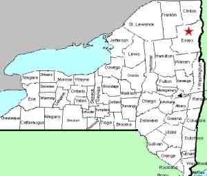
| Directions
From the hamlet of Keene, just north of where NY Routes
73 and 9N split, take 73 north. Just before crossing
the river, the Hulls Falls Road will be on your left.
Take this for 1.6 miles and you will cross a bridge.
The waterfall is under this bridge.
|
| County: |
Essex |
| Town: |
Keene |
| USGS Map: |
Keene Valley |
| Waterway: |
Ausable River East Branch |
| Latitude: |
N 44o 14' 06" |
| Longitude: |
W 73o 47' 40" |
| Type: |
Cascade |
| Drop: |
20' |
| Region: |
North of Keene |
| Parking: |
Roadside |
| Trail type: |
Dirt |
| Length of hike: |
1 minute |
| Difficulty: |
Easy |
| Accessibility: |
Some public, some posted |
| Name: |
Official |

|
Hulls Falls is located on the Hulls Falls Road, also known as
Essex County Route 69. Be aware that the other end of the
Hulls Falls Road intersects Route 73 on a stretch where 73 and 9N
are running together, a little less than 2.5 miles south of the
point noted in the directions side-bar. From this end, the
bridge is only 0.9 miles. If you inadvertently take the southern
end not knowing that there are two ends, you will cross this bridge
and not realize it is what you are looking for. People have
been known to make this mistake!
This is a very nice little waterfall that drops in two steps.
The upper step is just above the bridge and the lower step, which
splits around a large boulder in the stream, is just downstream
of it. Some of the land on the downstream side is private
and posted, so please be aware of that when you visit this area.
Thanks to Christy Hibsch who has provided some pics of the lower
drop.
The Hulls Falls is on the East Branch of the Ausable River.
The East Branch and the West Branch join forces downstream at Au
Sable Forks to form the Ausable River. This waterfall rich
river empties into Lake Champlain in the town of Peru.
Latest update: March 26, 2014
|


