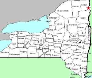
| Directions
In the village of Keeseville, Main Street is also NY
22. The falls are visible upstream from the bridge
crossing the Ausable River.
|
| County: |
Clinton/Essex |
| Town: |
Ausable/Chesterfield |
| USGS Map: |
Keeseville |
| Waterway: |
Ausable River, East Branch |
| Latitude: |
N 44° 30' 16" |
| Longitude: |
W 73° 28' 56" |
| Drop: |
10' |
| Type: |
Slide |
| Region: |
In the village of Keeseville |
| Parking: |
Streetside |
| Trail type: |
Street |
| Length of hike: |
1 minute |
| Difficulty: |
Easy |
| Accessibility: |
Public |
| Name: |
Common |

|
 These falls at Keeseville are visible
from the bridge crossing the Ausable River on Main Street.
Main Street is also State Highway 22 and this bridge is the only
one in the village! These falls at Keeseville are visible
from the bridge crossing the Ausable River on Main Street.
Main Street is also State Highway 22 and this bridge is the only
one in the village!
The community of Keeseville was originally known as Anderson
Falls. The namesake of that was John Anderson, an original
settler. In 1812 he sold his property to Richard Keese
and the name of the community was changed. However, the waterfall
is still known as Anderson Falls. Many sources indicate that
there has been a mill of one type or another at this location for
many years. A dam may have also once existed here.
The Ausable River empties into Lake Champlain in the town of
Peru.
Last update: April 29, 2017
|


