| Directions
North of Utica on NY 12, there is a point
at which NY 12 and NY 28 run concurrently.
From the southern point of concurrency, take NY 28
south. Trenton Falls Road is the first junction
exiting to the east. Follow signs to a four-way stop where
you should continue to the end of the road where you can
park.
|
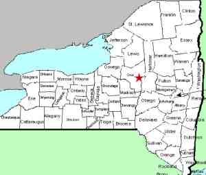
| County: |
Oneida/Herkimer |
| Town: |
Trenton/Russia |
| USGS Map: |
Remsen |
| Waterway: |
West Canada
Creek |
| Latitude: |
N 43°
16' 55" |
| Longitude: |
W 75°
09' 12" |
| Drop: |
25' |
| Type: |
Curtain cascade |
| Region: |
North of Utica |
| Parking: |
Parking area |
| Trail type: |
Crushed stone/wood
chip paths |
| Length of
hike: |
1 - 1.5 hours |
| Difficulty: |
Moderate |
| Accessibility: |
Public |
| Name: |
Official |
|
 The Trenton Falls Scenic Trail contains a number of waterfalls
and dams. We would ask you to refer to our Trenton
Falls page for general information about the area. Also note that it is only
open on a limited basis. The Town of Trenton website should
be consulted to find those dates. The Trenton Falls Scenic Trail contains a number of waterfalls
and dams. We would ask you to refer to our Trenton
Falls page for general information about the area. Also note that it is only
open on a limited basis. The Town of Trenton website should
be consulted to find those dates.Through this gorge, there is
a series of drops. Long considered a
two-tiered drop, today High Falls is commonly separated into
Lower and Upper High Falls. Although the sign at Upper
High Falls simply calles it High Falls, it officially became
Upper High Falls when it was entered into the GNIS on July 3,
2019.
Information we have found indicates that the total drop of
the pair is about 100'. We estimate that the upper portion accounts for about
25'
of that.
We have classified this as a curtain cascade. On our
visits, this waterfall was considerably wider than it was tall. We do have contributor pictures and have seen
other photos where, due to lower waterflow, is more of a ribbon
cascade.
Note that although the trail to Mill Dam Falls and Hydro
Falls, which are both upstream of Upper High Falls, is currently
closed, you can see those two drops in the photos of Upper High
Falls.
The West Canada Creek empties into the Mohawk River, which then
flows into the Hudson before reaching the Atlantic Ocean.
Last update: July 9, 2019
|


