| Directions
North of Utica on NY 12, there is a point
at which NY 12 and NY 28 run concurrently.
From the southern point of concurrency, take NY 28
south. Trenton Falls Road is the first junction
exiting to the east. Follow signs to a four-way stop where
you should continue to the end of the road where you can
park.
|
| County: |
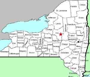
Oneida/Herkimer |
| Town: |
Trenton/Russia |
| USGS Map: |
Remsen |
| Waterway: |
West Canada
Creek |
| Latitude: |
N 43°
16' 24" |
| Longitude: |
W 75° 09'
35" |
| Drop: |
270' total |
| Type: |
Multiple
drops |
| Region: |
North of Utica |
| Parking: |
Parking area |
| Trail type: |
Crushed stone/wood
chip paths |
| Length of
hike: |
1 - 1.5 hours |
| Difficulty: |
Moderate |
| Accessibility: |
Public |
| Name: |
Common |

|
This is a
truly magnificent site. Nature and the West Canada Creek have
worn a large gorge through this area. There are several on-line
sources that claim that this area at one time "nearly rivaled
Niagara Falls in terms of tourist magnetism." It is still
publicly accessible, but is only open about two week-ends each
year. The
Town of Trenton website should be consulted to find those dates.
Now a major hydroelectric project area, there are still a number
of magnificent waterfalls here, which we have created separate
pages for. The area is divided into several
drops. The 60' tall Morgan Dam is the furthest downstream,
but that is actually below where the walking tour begins.
After entering the facility and head out on the trail, you will encounter
Sherman Falls then
the two-tiered High Falls, which are identified as
Lower High Falls
and Upper High Falls.
Please note that the map you will receive on your visit uses
these two terms, but signs at the location refer to the upper
drop simply as High Falls. These drop a total of 100 feet.
Above that is the 14' Mill Dam Falls and at the very upper part
of the area is the Upper Hydro Dam and Falls.
On July 3, 2019, the names of Mill Dam Falls, Upper High
Falls, Lower High Falls and Sherman Falls all became official
when they were entered into the GNIS.
This is a very nicely maintained area with finely crushed stone
paths and wood mulch side trails that allow views of the waterfalls
and the gorge. The one down-side is that the area is open
on a limited basis. There is no fee to access the facility.
Sometime before or during the spring of 2013, a rock-slide had blocked the upper trail and
you couldn't go beyond High Falls. You do have distant
views of Mill Dam Falls
and Hydro Falls from the Upper High Falls viewing area, but you
can no longer get to those viewing areas. You also can not see
the hydro dam at the top.
On our visit there in 2013, we were told that there was no
estimated date at which time this slide could be cleared so that
upper access could be restored. On a return trip in 2019,
we were told that the cost to repair this damage was prohibitive
and repairs are not going to happen. This is despite the
fact that the
map you receive on your visit does indicate that
this section of the trail "is
temporarly [sic] closed".
There is much history and nature at this location and much can
be written about it and has been. There are many on-line sources
with information and stories about this area. We will let
our pictures tell the story. Rather than reinventing the wheel,
please refer to some of the info out there such as
Discovering the Valley of the Crystals, a well-done story of
the history of Trenton Gorge, complete with pictures. This
is by no means the only resource out there. A web search will
turn up many options.
The West Canada Creek empties into the Mohawk River, which then
flows into the Hudson before reaching the Atlantic Ocean.
Last update: July 9, 2019
|


