| Directions
There are two parking areas for this hike located on
NY 73 between the trailhead for Giant Mountain/Roaring Brook
Falls and the intersection of US 9. The larger of
the two, which we will call parking area #1 is on your left,
0.7 miles from the Roaring Brook Falls trailhead as you
drive toward Chapel Pond. This point is 0.6 mile from
the Chapel Pond parking area. Parking area #2 is
0.1 mile closer to Chapel Pond, on the opposite side of
the road.
|
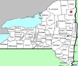
| County: |
Essex |
| Town: |
Keene |
| USGS Map: |
Keene Valley |
| Waterway: |
Unnamed waterway |
| Latitude: |
N 44o 8' 38.86" |
| Longitude: |
W 73o 45' 33.48" |
| Drop: |
150' |
| Type: |
Ribbon cascade |
| Region: |
South of Keene |
| Parking: |
Unpaved lot |
| Trail type: |
Dirt |
| Length of hike: |
15 minutes |
| Difficulty: |
Easy |
| Accessibility: |
Public |
| Name: |
Common |
|
The Beer Walls of Keene Valley, also known as Chapel Pond Canyon,
is a very popular rock climbing location. In fact, the website
adirondack.net claims it is "the Adirondack's most popular
single pitch climb".
There are two trailheads in this vicinity. Do not take
the one that exits from parking area #2. About half- way between
the two parking areas, there is a trailhead on the same side of
the road as area #2 with a log bridge that crosses the ditch.
This trail leads to a section between the upper and lower walls.
It is our understanding that specific directions are given at this
point.
The waterfall here is a 150' plunge down a sheer wall.
Be advised that it is only flowing in the spring or after a heavy
rain. Rock climbers apparently gave the area its name.
It seems that the water cascading over the rocks is not the only
liquid of interest to these climbers! The area is divided
into several sections, all named to commemorate the aforementioned
liquid. The waterfall aficionado is probably only concerned
with Upper Beer Wall and Lower Beer Wall.
The coordinates we have posted are approximate based on information
we have found on-line. our thanks to John Haywood for his
pictures of this waterfall.
Although we haven't been able to specifically locate the waterway,
it appears that it would flow into Beede Brook which flows into
the East Branch of the Ausable River. Since Beede Brook does
not contain any waterfalls that we know of, we have by-passed that
step in our menu. The East Branch and the West Branch join
forces downstream at Au Sable Forks to form the Ausable River.
This waterfall rich river empties into Lake Champlain in the town
of Peru.
Last update: July 31, 2015
|


