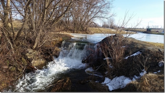
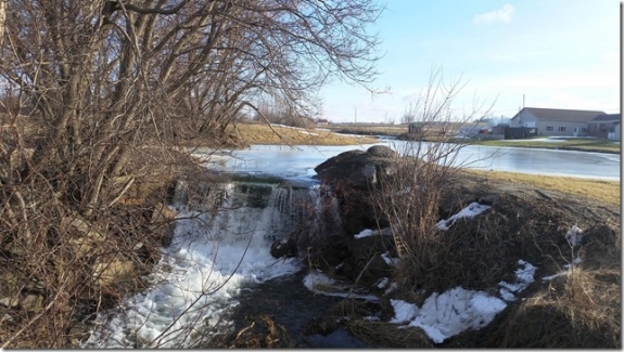
| Directions
On US 11, roughly half way between I-81 exit 43 and
Watertown's Outer Washington Street, Cagwin Road will
exit to the east. This is a little over a mile
north of Talcott Falls. At the other end of this
road, which is less than a mile long, this small
waterfall will be on the left.
|
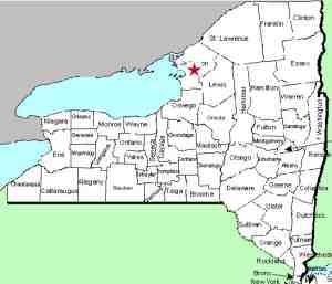
| County: |
Jefferson |
| Town: |
Watertown |
| USGS Map: |
Watertown |
| Waterway: |
Stony Creek |
| Latitude: |
N 43° 53' 50" |
| Longitude: |
W 75° 56' 41" |
| Drop: |
5' |
| Type: |
Curtain cascade |
| Region: |
South of Watertown |
| Parking: |
Roadside |
| Trail type: |
NA |
| Length of hike: |
NA |
| Difficulty: |
Easy |
| Accessibility: |
Private, with a roadside
view |
| Name: |
Unnamed |
|
This is a very tiny roadside view waterfall. It is on
private property, but is within a few feet of the road so access
is not an issue. It is near the corner of the Cagwin and
Dry Hill Roads and can easily be seen from the side of Cagwin
Road.
It is unnamed but we have given it this moniker to
facilitate cataloging. It is less than two miles, as the
crow flies, from the popular Talcott Falls and is on the same
creek.
The Stony Creek is actually one of the smallest waterways that
flows into Lake Ontario that contains a waterfall. Further
downstream, it flows through the village of Henderson. Its
outlet into Lake Ontario is just south of Stony Point in the town
of Henderson.
Last update: February 8, 2017
|