| Directions
This waterfall is located on private property.
|
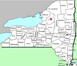
| County: |
Lewis |
| Town: |
Lowville |
| USGS Map: |
Lowville |
| Waterway: |
Silver Creek |
| Latitude: |
N 43° 46' 56" |
| Longitude: |
W 75° 30' 00" |
| Drop: |
40' |
| Type: |
Step |
| Region: |
The village of Lowville |
| Parking: |
NA |
| Trail type: |
NA |
| Length of hike: |
NA |
| Difficulty: |
NA |
| Accessibility: |
Private/posted property |
| Name: |
Common |

|
These falls are not even indicated on topographical
maps. We found two Internet sites about Lewis County waterfalls
that referenced them so we thought we would check them out.
One of these sites made the following statement: "This
small cascade is a beautiful, tranquil escape right in your own
backyard." We will agree with half of that statement.
This is a beautiful location. The part we take exception to
is the "in your own backyard" part. It is not in
your backyard or my backyard. It is in the
backyard of a family that has been dealing with a disrespectful
public for way too long. It is private and posted land. Please respect
their property and privacy.
These falls descend through several drops and are truly
gorgeous. It is the kind of waterfall you'd expect to hike
a significant distance to see.
Over the years, this location has been known as Silver
Creek Falls and Silver Mine Falls.
The Silver Creek flows into the Mill Creek which flows into the
Black River. There is another Mill Creek in Jefferson County.
That one originates on Dry Hill and flows into Lake Ontario in Sackets
Harbor.
Last update: June 7, 2017
|


