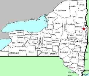
| Directions
On the road leading to
Shelving Rock Falls,
these waterfalls can be seen on the left about 1.5 mile
before reaching the trailhead for Shelving Rock Falls.
|
| County: |
Washington |
| Town: |
Fort Ann |
| USGS Map: |
Shelving Rock |
| Waterway: |
Shelving Rock
Brook |
| Latitude: |
N 43°
32' 22" |
| Longitude: |
W 73°
34' 27" |
| Drop: |
15' |
| Type: |
Cascade |
| Region: |
Off NY 149
west of Fort Ann |
| Parking: |
See text |
| Trail type: |
Roadside |
| Length of
hike: |
Roadside |
| Difficulty: |
Easy |
| Accessibility: |
Private |
| Name: |
Unnamed |

|
Although the property surrounding these falls is posted, they
are close enough to the road that you can get pictures from the
right-of-way. Although there are a number of signs in
the area indicating that there is no parking on the Shelving
Rock Road, if you are traveling with a companion who can stay in
the car, you technically are "Standing" and not "Parking".
Please note that the coordinates we have given
are approximation.
Shelving Rock Brook empties into Lake George. The water
from this then flows through La Chute into Lake Champlain.
The flow then goes north through Canada on the Richelieu River and
empties into the St. Lawrence River.
Last update: August 26, 2017
|


