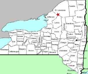
| Directions
This waterfall is located on private property off the
Country Club Road in the town of Fowler, south of
Gouverneur. It can only be accessed with the
owner's permission.
|
|
County: |
St. Lawrence |
|
Town: |
Fowler |
|
USGS Map: |
Gouverneur |
|
Waterway: |
Sawyer Creek |
|
Latitude: |
N 44° 17' 44" |
|
Longitude: |
W 75° 27' 57" |
|
Drop: |
15' |
| Type: |
Flume |
| Region: |
South
of the village of Gouverneur |
| Parking: |
NA |
| Trail
type: |
NA |
| Length
of hike: |
NA |
| Difficulty: |
NA |
| Accessibility: |
Private |
| Name: |
Common |

|
 As
the directions and data bars say, this waterfall is on private
property. Having lived in this general area for close to
forty years, two different people had told me about growing up
near this falls and spending time at it when they were young.
It has been known simply as the Gorge for as long as any of them
can remember. As
the directions and data bars say, this waterfall is on private
property. Having lived in this general area for close to
forty years, two different people had told me about growing up
near this falls and spending time at it when they were young.
It has been known simply as the Gorge for as long as any of them
can remember.
The primary waterfall is at the top of the descent.
This is a close to vertical drop followed by a series of
rapids-like drops over the next fifty or so feet of the creek.
Sawyer Creek flows into Matoon
Creek which empties into the Oswegatchie River just upstream of
Gouverneur. The Oswegatchie flows into the St. Lawrence
River in Ogdensburg. Last update: October 30, 2017
|


