| Directions
In the village of Cadyville, take Park Row off US 3.
At the end, take a right and then a quick left onto Kent
Falls Road. In about 0.2 mile, there is a access
road on the right. There is a parking area just
before it.
|
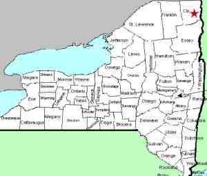
| County: |
Clinton |
| Town: |
Plattsburgh/Schuyler
Falls |
| USGS Map: |
Morrisonville |
| Waterway: |
Saranac River |
| Latitude: |
N 44° 41'
46" |
| Longitude: |
W 73°
36' 48" |
| Drop: |
NA |
| Type: |
Dam |
| Region: |
West of Plattsburgh |
| Parking: |
Unpaved
lot |
| Trail type: |
Dirt |
| Length of
hike: |
About 700' |
| Difficulty: |
Easy |
| Accessibility: |
Public |
| Name: |
Common |
|
We first learned about Oxbow Falls from an old friend that grew
up in this area. There is now a power plant at this
location, but there is still a small waterfall below the dam.
This waterfall probably got its name because it is just upstream
from a large bend, or
oxbow, in the river.
From the parking area, you can see the hydro facility,
operated by New York State Electric and Gas Corp (NYSEG), below.
The dam and waterfall is located just behind it. To the
NYSEG, this is the Mill C Dam.
The Saranac River empties into Lake Champlain just downstream
in the city of Plattsburgh.
Last udpate: May 9, 2016
|


