| Directions
Take Duane Street in the village of
Malone. This turns into CR
25. Continue to the hamlet of Chasm Falls and
turn left onto CR 27/Pond Road. In just over
three miles, please note that CR 27 makes a right turn
as you enter the hamlet of Owls Head. In another
1.5 miles or so,
take a right on the Barnesville Road. There
will be a sign indicating the "Big Salmon River
Public Fishing Stream". If you come to the
Trailside Tavern, you have gone just a bit too far.
In about 3/4 mile, you will come to a "Titusville
Mt. State Forest ... High Falls" sign.
|
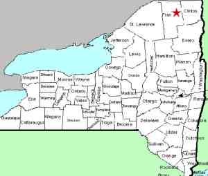
| County: |
Franklin |
| Town: |
Bellmont |
| USGS Map: |
Owls Head |
| Waterway: |
Salmon River |
| Latitude: |
N 44° 42'
36" |
| Longitude: |
W 74° 10'
22" |
| Drop: |
~30' |
|
Type: |
Step cascade |
|
Region: |
Southeast of Malone |
|
Parking: |
Roadside |
|
Trail type: |
Dirt |
|
Length of hike: |
3/4 of a mile, one-way |
|
Difficulty: |
Moderate |
|
Accessibility: |
Public |
|
Name: |
Official |

|
Another of
the several High Falls in northern New York, this one is located
in a slightly more remote area than most. Although not deep
in the Adirondacks at this point, it is in a relatively sparsely
populated area. To call the Barnesville Road a road is a bit
of a stretch! It is a single lane dirt road with lots of rocks
and bumps. The parking area isn't much more than a slightly
wider spot in the road. This area is accessed off the Pond
Road, just south of the hamlet of Owls Head and west of Mountain
View. For the most part, the trail is fairly well maintained although
we did find some stretches that needed some help. We suspect
that it was damaged in the recent spring run-off which was quite
harsh and the group that maintains it hadn't gotten around to fixing
it yet. The sign indicates a hike of 0.75 miles, but our GPS
showed it to be a bit less than that. The only reason we classified
is as a moderate hike is because of its length.
You are rewarded for your 1.5 mile round-trip hike with a beautiful
set of falls. There are several steps through a stretch where
the river narrows. We were there in July and there was ample
flow. This stretch would probably be quite impressive in the
spring during high water.
The Salmon River flows north into Canada and then empties into
the St. Lawrence River.
Last update: September 27, 2016
|


