| Directions
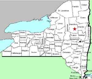
Christine Falls is located on a stretch of NYS Routes
30 and 8 that run together from Speculator to just north
of Wells. 3.0 miles east of where these highways come
together in Speculator you will come to the old Route 30
on your left. Just past this corner, the road will
take a bend to the left and about 0.3 miles there is a break
in the wire guard rails on your left. This is the
entrance to the "parking area" for Christine Falls.
If you are traveling from the south, this point is a little
over 6 miles from where 30 and 8 split just north of Wells.
|
| County: |
Hamilton |
| Town: |
Wells |
| USGS Map: |
Page Mountain |
| Waterway: |
Sacandaga River |
| Latitude: |
N 43° 30'
44" |
| Longitude: |
W 74° 18'
37" |
| Drop: |
40' |
| Type: |
Curtain cascade(s),
slide, flume |
| Region: |
Between Wells
and Sacandaga |
| Parking: |
Unpaved lot |
| Trail type: |
Dirt, rock |
| Length of hike: |
0.1 mile |
| Difficulty: |
Easy |
| Accessibility: |
Public |
| Name: |
Official |

|
 You will drive down a short embankment over a stone road to get
to the parking area. From here, you will find a trail at the
end of the area that leads to the base of the falls. You will drive down a short embankment over a stone road to get
to the parking area. From here, you will find a trail at the
end of the area that leads to the base of the falls.
These falls are located just downstream from a hydro facility.
They are a multi-step falls, in two distinct sections. The
top section contains a number of steps and slides. A hundred
feet or so downstream is the lower section. Between the two
is a series of slide type plunges, rapids and flume. To return
to your vehicle, you can actually climb the embankment and you will
end up at the other end of the parking area from where you entered.
The Sacandaga River flows through a number of lakes as it makes
its way to the Hudson River whose final destination is the Atlantic
Ocean.
Last update: August 26, 2017
|


