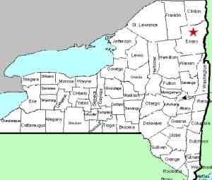
| Directions
From NY 73, just north of the hamlet of Keene Valley,
the Beede Road exits to the east. This waterfall
is in this area, a little over 1/2 mile from this
intersection.
|
| County: |
Essex |
| Town: |
Keene |
| USGS Map: |
Keene Valley |
| Waterway: |
Phelps Brook |
| Latitude: |
N 44°
12' 05" |
| Longitude: |
W 73°
46' 27" |
| Drop: |
NA |
| Type: |
NA |
| Region: |
North of Keene
Valley |
| Parking: |
NA |
| Trail type: |
NA |
| Length of hike: |
NA |
| Difficulty: |
NA |
| Accessibility: |
Unknown |
| Name: |
Official |

|
Although we have made a couple of trips up this road searching,
we have not yet been able to locate this waterfall. If anyone
has any information or pictures of this waterfall, please
contact us. The Phelps
Brook flows into the Ausable River which empties into Lake
Champlain in the town of Peru.
Last update: June 11, 2016
|


