| Directions
On NY 58 southeast of the hamlet of Edwards, there is
a canoe launch operated by Brookfield Energy. It
is a little less than a mile into Fine from the Edwards/Fine
town line.
|
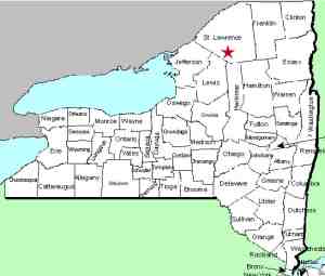
| County: |
St. Lawrence |
| Town: |
Fine |
| USGS Map: |
South Edwards |
| Waterway: |
Oswegatchie River |
| Latitude: |
N 44° 15'
02" |
| Longitude: |
W 75° 10'
51" |
| Drop: |
3' |
| Type: |
Rapids |
| Region: |
Southeast of Edwards |
| Parking: |
Roadside |
| Trail type: |
Water access |
| Length of hike: |
1.1 mile |
| Difficulty: |
Easy |
| Accessibility: |
Water |
| Name: |
Unnamed |
|
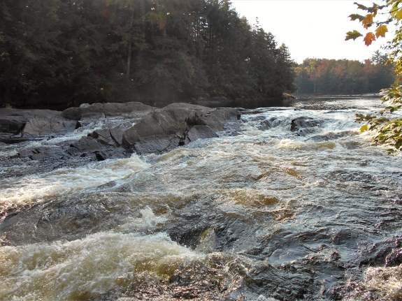
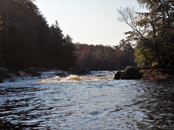
On a stretch of the Oswegatchie River near the Edwards/Fine
town line and between the South Edwards Dam and Grease Falls, there
are six drops.
The information and pictures on this location were submitted
by a contributor. The property around it is owned by Erie
Boulevard Hydro so it probably posted. This is a water access only
situation.
This drop is just over one mile upstream from the canoe launch.
In keeping with our policy of giving
names to these unnamed falls based on the waterway they are on,
and since this is the first of the drops you encounter from the
canoe launch, we have chosen this name. It
should not be confused with Oswegatchie Falls, which is about
1.25 miles downstream from this location.
The Oswegatchie River flows to the St. Lawrence River in the
city of Ogdensburg.
Last update: September 26, 2017
|