| Directions
Just north of the Beaver River in Belfort,
head east on the Long Pond Road. After a few miles,
you will cross the "Blue Line" which means you
are in the Adirondack Forest Preserve. Shortly, you
will cross the river and on the left just past the bridge,
there is a parking area. This is a fishing access
site right next to
Grunerts Falls. Follow
the trail heading downstream on the same side of the river
and you will find Iowa Falls.
|
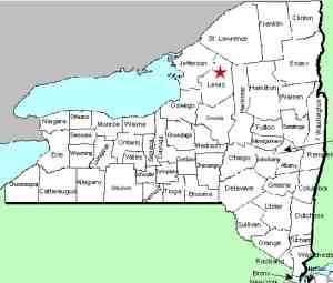
| County: |
Lewis |
| Town: |
Croghan |
| USGS Map: |
Stillwater |
| Waterway: |
Oswegatchie
River, West Branch |
| Latitude: |
43°
58' 54" |
| Longitude: |
75°
14' 25" |
| Drop: |
30' |
| Type: |
Segmented
cascade |
| Region: |
Northeast
of Croghan |
| Parking: |
Unpaved lot |
| Trail type: |
Dirt |
| Length of
hike: |
3/4 mile |
| Difficulty: |
Easy |
| Accessibility: |
Public |
| Name: |
Common |
|
 A previous report that
the area leading to Iowa Falls is posted appears to be unfounded.
It is true that the land around the trailhead is posted, but the
trail itself is publicly accessible. In fact, yellow DEC markers
are visible on trees in that area. The trailhead to Iowa Falls
is not immediately on the river bank, but a few yards up the bank.
The hike is fairly easy and the trail well marked. This trail
includes a fairly long wooden walkway across a swamp. When
you reach the falls, there is a bridge with wooden decking and rails
mounted on metal beams which give you access to the other side of
the channel. A previous report that
the area leading to Iowa Falls is posted appears to be unfounded.
It is true that the land around the trailhead is posted, but the
trail itself is publicly accessible. In fact, yellow DEC markers
are visible on trees in that area. The trailhead to Iowa Falls
is not immediately on the river bank, but a few yards up the bank.
The hike is fairly easy and the trail well marked. This trail
includes a fairly long wooden walkway across a swamp. When
you reach the falls, there is a bridge with wooden decking and rails
mounted on metal beams which give you access to the other side of
the channel.
Iowa Falls drops in the river at this point and goes around an
island. The falls in the main channel is a very pretty site.
At low water in early September, after crossing the bridge, we were
able to make our way across to the island. A short hike across
this brought us to the back side of the island where we found a
natural waterslide in the channel that went around the back of the
island. There was also a trail from the bridge to this location
on the mainland side.
The West Branch of the Oswegatchie River flows into the main
branch just downstream of the hamlet of Talcville in the town of
Edwards, St. Lawrence County. From here, it is downstream
through Gouverneur to the St. Lawrence River in Ogdensburg, New
York.
Webmaster's note: There have also been references
to this area as Iona Falls. The common name is Iowa but this
alternate reference might be due to local vernacular. Iowa
Falls is the established name.
Last update: July 1, 2017
|


