| Directions
This location is upstream from Fullerville Falls and
probably only accessible by water. We are looking
into the possibility of land access.
|
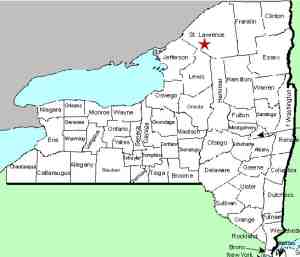
| County: |
St. Lawrence |
| Town: |
Fowler |
| USGS Map: |
Edwards |
| Waterway: |
Oswegatchie River
West Branch |
| Latitude: |
N 44°
15' 27" |
| Longitude: |
W 75°
20' 17" |
| Drop: |
NA |
| Type: |
NA |
| Region: |
Southeast of Gouverneur |
| Parking: |
NA |
| Trail type: |
Water access |
| Length of hike: |
NA |
| Difficulty: |
NA |
| Accessibility: |
NA |
| Name: |
Official |
|
While doing research, we discovered a clause in the historical
booklet Town of Fowler ... Bicentennial History ...
1807-2007. From page 12 of that document, "A
few rods north of the bridge at the foot of the rapids is the
site of the fire-destroyed Ontario Talc Mill, while a short
one-fourth mile above the natural dam is a water power upon
which the late Chester Sprague erected a mill for the
manufacture of lumber and shingles. A short distance south
reaches what was known as the Hazelton Falls upon which was
operated a shingle mill. A bit farther upstream is a power
site known to earlier settlers as Hill Falls. A short
space further in the same direction appear Mill Falls so called
by reason of a mill being located there." In cooperation
with Karen Simmons, Fowler Town Historian, we are continuing to
look into this, but at this point we believe that this "natural
dam" referred to is actually Fullerville Falls.
Given the access question, we have not yet been to this
location. A search of satellite images and topographical
maps leads us to surmiss that Hazelton Falls is 1/2 mile due
south of Sprague Falls. These two waterfalls are separated
by two straight segments of about 2000 feet each with a sweeping
90° bend between them.
This leads us to the belief that a shingle mill was operated
here by someone named Hazelton back in the 1800s.
Until we are able to access this location, we have provided an
image from googlemaps.com.
In early 2019, we were notified of
another document referencing Hazleton Falls. As a result
of it, and as part of our Waterfall Naming Project, Hazleton
Falls was added to the Geographic Names Information System data
base on April 19, 2019.
The Oswegatchie River flows into the St. Lawrence River in
Ogdensburg, New York.
Last update: April 23, 2019
|


