| Directions
From I-87, exit 29, proceed west on
the Blue Ridge Road (CR 84) for about 17 miles.
The turn for Tahawus (CR 25) will be on your right.
From the other direction, this is about 1.6 miles from
the intersection of CR 2 with NY 28N. Follow
25 north and it will become a dirt road leading
to the parking area for hikers.
|
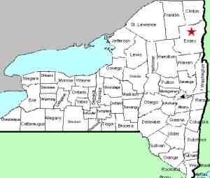
| County: |
Essex |
| Town: |
Newcomb |
| USGS Map: |
Mt Marcy |
| Waterway: |
Opalescent
River |
| Latitude: |
N 44°
06' 06" |
| Longitude: |
W 73°
59' 27" |
| Drop: |
75' |
| Type: |
NA |
| Region: |
Off CR 2 between
Newcomb and North Hudson |
| Parking: |
Unpaved lot |
| Trail type: |
Dirt/rock |
| Length of
hike: |
6-7 miles,
one way |
| Difficulty: |
Difficult |
| Accessibility: |
Public |
| Name: |
Official |

|
There are two approaches to this
waterfall, 6 or 7 miles depending on which trail one takes.
The shorter route takes the Calamity Brook Trail to Flowed Lands
and then goes down to the falls from the outlet to Flowed Lands.
The longer approach is a flat walk for 6 miles, and then a climb
to the falls. There are several major unnamed falls above
Hanging Spear Falls. Access to the base of the falls is very
steep and dangerous, although there are a few viewpoints from the
trail.
According to Tony Goodwin,
Executive Director of the Adirondack Trail Improvement Society,
this waterfall was named in 1838
by the English writer Charles Fenno Hoffman who changed the name
from "East River Falls". He also renamed the "East
River" the Opalescent River while naming Mt. Marcy "Tahawus"
- all because these names would seem more romantic to his English
readership.
The Opalescent River empties into the Hudson River just south
of Tahawus, a former mining community. The Hudson flows into
the Atlantic Ocean in New York City.
Last update: April 8, 2016
|


