| Directions
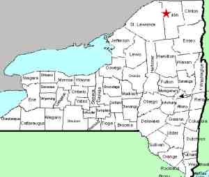
NY 458 connects NY 11B just south of Nicholville with
the village of St. Regis Falls. Just inside
Franklin County at the St. Lawrence County line, within
sight of the end of the Days Mills Road, the road
crosses the Lake Ozonia Outlet. This drop is in
view on the southwest side of the highway.
|
| County: |
Franklin |
| Town: |
Waverly |
| USGS Map: |
St. Regis
Falls |
| Waterway: |
Lake
Ozonia Outlet |
| Latitude: |
N 44° 40'
37" |
| Longitude: |
W 74°
37' 08" |
| Drop: |
~10' |
|
Type: |
Rapids |
|
Region: |
West of St. Regis Falls |
|
Parking: |
Roadside |
|
Trail type: |
Roadside |
|
Length of hike: |
Roadside |
|
Difficulty: |
Easy |
|
Accessibility: |
Public |
|
Name: |
Unnamed/Charted |

|
Althought this is noted on topographical maps as "Rapids", we
have included it as a waterfall. This one, with a roadside
view, is
typical of hundreds of ribbon cascades throughout Northern New York.
It stretches through 100 feet or so of this creek as it splashes
over the small boulders in this stream.
This waterway empties into the St. Regis River a little over
1/2 mile north of here. This flows into Canada and then empties
into the St. Lawrence River a short distance downstream from the
New York/Quebec border.
Last update: August 18, 2017
|


